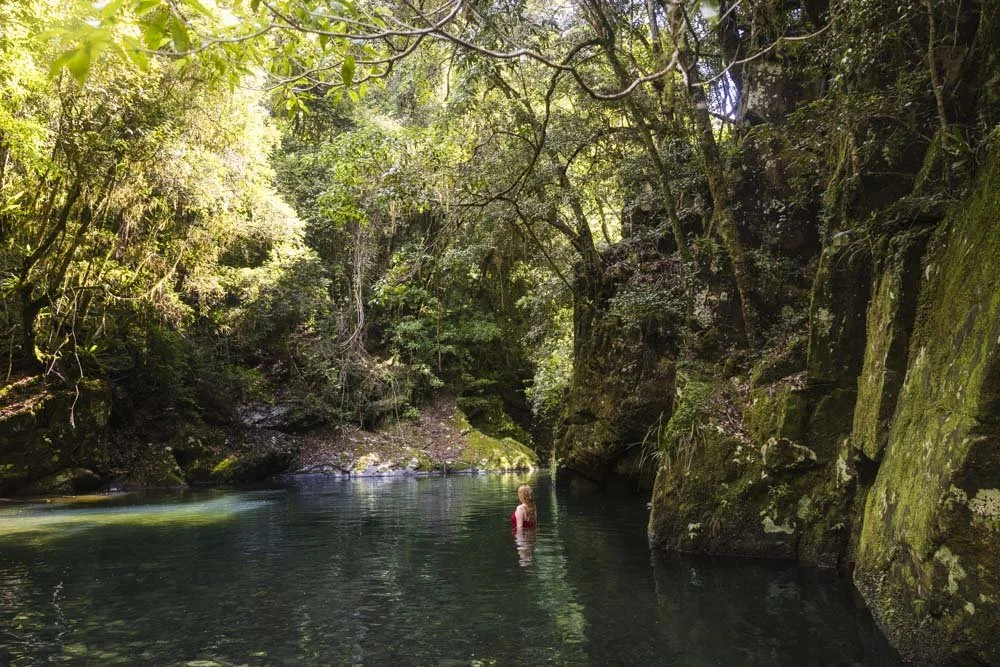
Problem Creek Falls is a beautiful gorge waterfall that cascades into a small, but crystal clear swimming hole. A few fallen trees have partially blocked the falls, so it’s not quite as picturesque as it would otherwise be, but it’s still a fabulous spot - especially if you’re looking for a secluded dip.
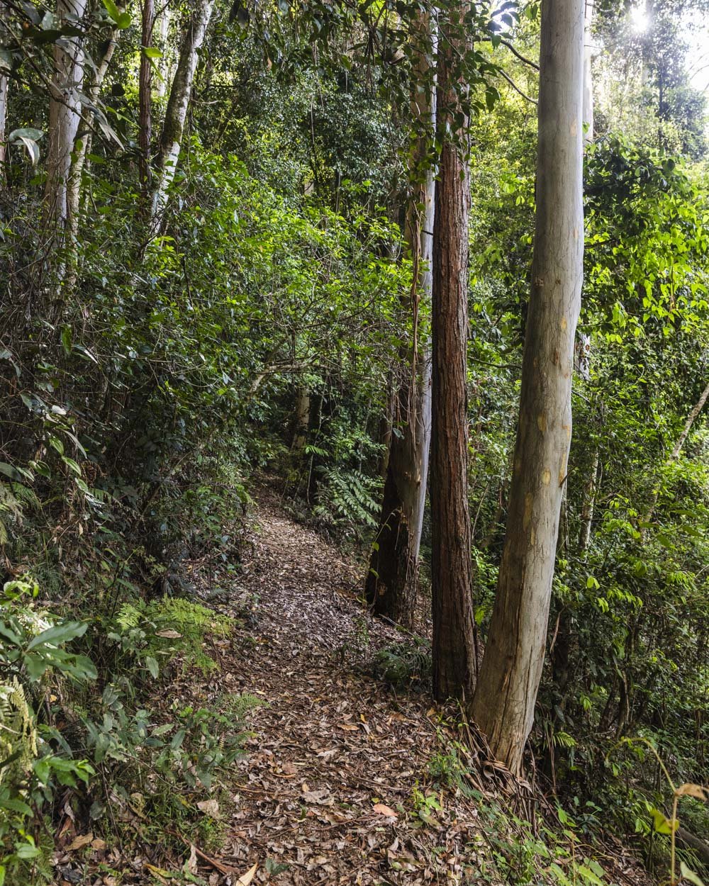
The walk to reach the falls is through a stunning patch of rainforest. We visited in the late afternoon and the dense rainforest canopy blocked most of the light, which combined with the eerie calls of the Catbird made for a very atmospheric walk.
Here’s everything you need to know about visiting Problem Creek Falls.
The walk to Problem Creek Falls
The stats
Distance: 3.6km return
Elevation gain: 150m
Difficulty: Easy, but not flat
Summary: The walk to Problem Creek Falls is not maintained by the national parks service, or the council, but by a wonderful group of volunteers (the Friends of Chichester). I was expecting that the trail might not be in the best shape as there probably wouldn’t be much funding, but they’ve done a wonderful job.
The track is in good condition and whilst there are some ups and downs, there are no long climbs. You’ll have to duck under, or hop over the odd bit of debris, but it’s never challenging. There is one very short narrow section of path leading down to the falls, but it’s not slippery when dry.
Starting the trail
From the northern end of Frying Pan Campground (the furthest side from where you drive in) the walk follows the small orange arrow along the grassy track.
After just a minute you’ll see a little signpost indicating the trail is to the left.
The path ahead looks quite dark and ominous, but after a very short uphill section, the trail takes you into a beautiful patch of rainforest.
It’s a dirt path, but despite recent rain, we didn’t really encounter any mud - though it could be different during a long wet winter.
Although it would be hard to go wrong, the track is marked at regular intervals with orange triangular markers.
Through the rainforest
After 250m (from the parking area) you’ll come to a set of small but pretty cascades before the path heads uphill to the left.
This uphill section lasts about 200m before it flattens. The track undulates much of the way to the falls, but there are also flat sections inbetween.
Next you’ll follow a path above the river, though any views are quite obscured by dense foliage. The trail can be narrow in places, but as it wasn’t slippery (when dry), it never felt precarious. Even sections that were covered in leaf litter were surprisingly stable.
You’ll walk through dense jungle with hundreds of hanging vines, knotted roots and mossy logs. We saw two lyrebirds scratching around in the undergrowth and heard many more, though it was the unusual sound of the Catbird’s cries that gave the walk a haunting quality.
After a mix of undulating and flat track you’ll reach the final descent to the falls, at the 1.6km mark. There is one very short, steepish section of dirt track leading downhill, but it wasn’t slippery.
You’ll then reach a large patch of tree fall and some rocks which sit in front of the little stony beach at the base of the falls (1.8km from the car park).
I crossed over the creek to reach the beach, which was easy, but watch for slippery rocks.
Problem Creek Falls
I didn’t really know what to expect from Problem Creek Falls and had no idea it was located in a small, but picturesque gorge.
The craggy rock walls give it a secluded feel and the pool at the base of the falls had a beautiful blue tint. If it weren’t for the four pesky logs lodged in front of the falls it would be even more special!
The gorge is very atmospheric and we were surprised to have it all to ourselves on a Saturday in summer - especially when the campground was so busy. Though we shouldn’t really be surprised because we had every swimming spot we visited to ourselves in Barrington Tops!
Although the pool is only small, it’s deep enough to swim (once you move into the middle) and it’s a gorgeous spot for a refreshing dip.
The water is cold, but was perfect in summer. I can imagine it feeling more like an ice bath in winter. Accessing the water is easy as you can walk straight in off the stony beach. The stones are not slippery, but a little tough on the feet.
The only thing that slightly mars this spot is there are a few leeches around the beach area. Having said that, I changed twice at the beach and we hung around for a fair amount of time by the water and never got one on us - though I did notice one heading for my towel and flicked it away.
If you are visiting during a wet period, I wouldn’t be put off, but I would keep an eye out and flick any you see away before they have a chance to latch. We also spray our boots and socks with Bushman’s if we see leeches around.
Keep them wild
Please remember to take all rubbish with you and keep these places wild and pristine - as with anywhere in the outdoors. It’s important to leave them exactly as you found them so they will remain beautiful for generations to come.
Litter tends to breed litter, so if you do spot any and are able to pick it up and dispose of it outside the area, it will go a long way to keeping the area clean.
Getting to the Problem Creek Falls trailhead
The walk to Problem Creek Falls begins at the Frying Pan Campground in the Chichester State Forest, close to Barrington Tops. The trailhead is at the northern end of the campsite, you can find the spot on Google Maps by clicking here. You’ll see a worn path at the far end of the campsite that indicates the start of the walk.
Frying Pan Campsite
The last 13km of the road to the campground is unsealed. At time of writing the road is in great condition and suitable for any vehicle in dry weather (if you have a small car and rain is forecast I wouldn’t risk it, as there are a few hills to get up and down).
Roads like this can deteriorate over time, especially after heavy rain, so if you don’t have a 4WD (and maybe even if you do) it’s best to check with the Forestry Corporation ahead of your visit. To reach the campground you do need to cross one ford, which for us was very shallow, but could be dangerous when the river is high.
The campground is gorgeous and located on the Telegherry River, which is a popular swim spot.
It’s located approximately 30km and a 35 minute drive from Dungog and 60km and one hour 15 minutes from Gloucester.
This post may contain affiliate links, meaning at no additional cost to you, that we will earn a small commission if you click through and decide to make a purchase. This helps towards the costs of running our website. Thanks for your support.


