Little Manning Falls is one of the lesser visited waterfalls in Barrington Tops, in fact, it’s so little visited that it doesn’t even have a name. We’ve named it Little Manning Falls as it’s located on Manning River and I think it deserves being called something other than ‘R8’, which is how it’s referred to on a topographical map!
It’s a lovely spot and reminded us quite bit of Gloucester Falls, the most popular waterfall in the park. The water colour is not as pretty as some due to the dark rocks in the pool, but it’s less than a five minute walk to get there, has a swimming hole at the base and you’re highly unlikely to share it with anyone else.
It’s not along a maintained track, but the path is in decent shape, though best not visited after too much rain so that the path does not become slippery.
Here’s how to find Little Manning Falls.

The walk to Little Manning Falls
The stats
Distance: 500m return
Elevation gain: 25m
Difficulty: Easy, but on a narrow unmaintained path
Trailhead: Layby on Gummi Road

The trail
There is room for one car to park beside the trailhead for the falls and it’s likely that this spot will be there waiting for you. If not you can park at the Gummi Picnic Area, which is a minute’s walk away (you’ll drive past it to reach the closer parking spot).


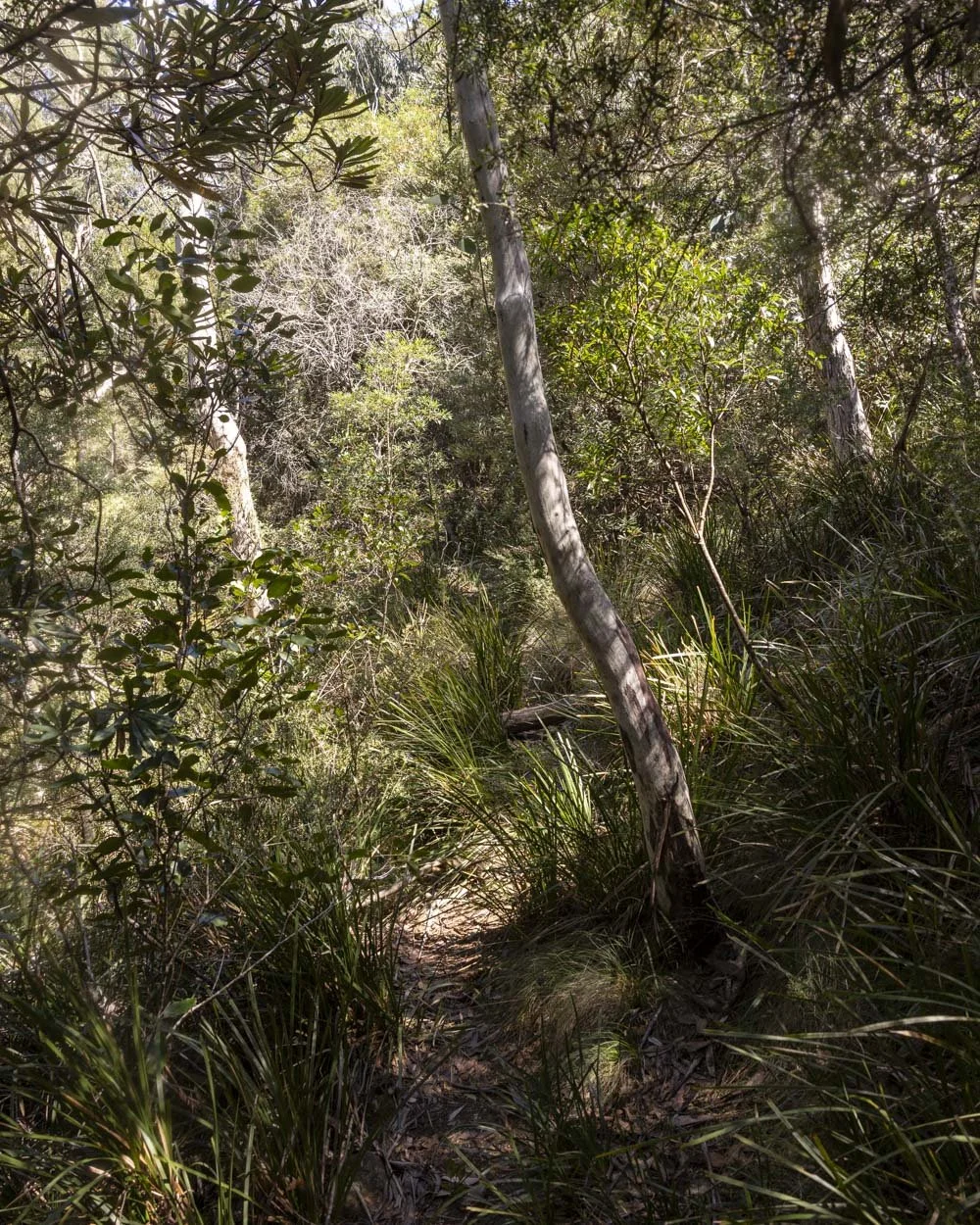
From the parking point you’ll see a worn path on the right. Follow the dirt track, which becomes rocky after 30m. At this point it will head uphill for roughly 20m.
It’s a little rough, but not difficult.

The path will become narrow and it’s a touch overgrown. You are a little way above the creek when the path narrows, so it may be uncomfortable if you are nervous of heights, but it’s only 70m before you make the turn to the bottom of the falls.

Before heading to the bottom you can make a short detour to the top of the falls. It’s 115m further along the trail and you’ll pop out of the bush and onto the rock platform.
There are small pools here and a good view over the top of the falls and into the pool below.

To reach the bottom of the falls you return to the junction and follow the track downhill for 20m. It’s a little steep, but not too loose and there are trees for stability if needed.
You will then reach the creek and cross the rocks and rock platform to reach the pool. Unless the water levels are unusually high this does not involve wet feet and the dry rock is grippy.

Swimming at Little Manning Falls
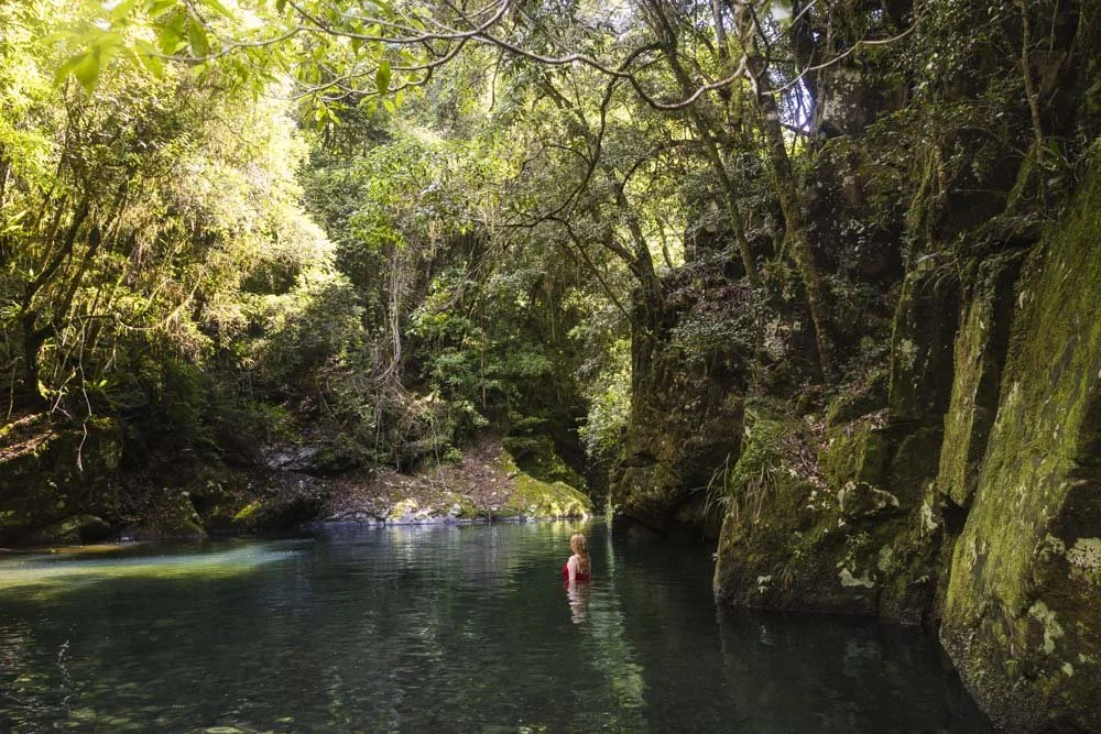
The rock platform at the base of the falls has plenty of room to spread out and relax and it’s a lovely serene spot. The falls were really pumping on our visit which is common for this part of Barrington Tops.

There is a large swimming hole at the base of the falls, which has a mix of deep and shallower water. Entry to the water is easy, as you can slide off the gently titled rock shelf and into the water. I say slide only because there was a fine layer of mud on the rock which made it potentially slippery for stepping off, but easy for sitting and gently sliding in.

Once inside the pool it’s a fantastic spot to cool off on a hot day and surprisingly the water was not cold as I’d been expecting. It’s usually cold in this area even in summer, but on our March visit it was cool, but by no means cold.
There are some large rocks in the pool, so if you intend on swimming it’s good to scope them out first. There was room to swim, but you had to be mindful of boulders in the middle of the pool and around the edges.

Keep them wild
Please remember to take all rubbish with you and keep these places wild and pristine - as with anywhere in the outdoors. It’s important to leave them exactly as you found them so they will remain beautiful for generations to come.
Litter tends to breed litter, so if you do spot any and are able to pick it up and dispose of it outside the national park, it will go a long way to keeping the area clean.
Getting to Little Manning Falls
Little Manning Falls is located in the Barrington Tops State Conservation Area, with space for one car to park at these coordinates: -31.860774, 151.552201.
If that spot is taken you can park a minute back up the road at Gummi Picnic Area.
The last 18km of the road to the trailhead is gravel, but in good shape and suitable for any vehicle at time of writing. Unsealed roads can deteriorate overtime and following big rain events, so if you are coming in a small car and are concerned about the road, it’s worth giving the National Parks Service a call before setting off. There is no phone signal in the park itself.
The closest town to the falls is Gloucester, roughly a 65km and a 1 hour 10 minute drive away.
This post may contain affiliate links, meaning at no additional cost to you, that we will earn a small commission if you click through and decide to make a purchase. This helps towards the costs of running our website. Thanks for your support.