Whilst many of the Peak District’s best known walks involve a fair amount of hills, there are a few gems which are entirely flat. The Lathkill Dale walk is one of them. We often find that the easier trails tend to be short, but happily this one is both long and leisurely, making it a perfect choice for when you want a proper walk without the excursion.
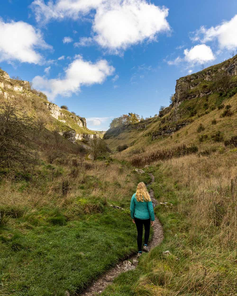
When it comes to scenery, it’s wonderfully varied, taking you through a limestone gorge, pretty woodland and to a small but picturesque waterfall. There’s even a series of old mine shafts - one of which can be explored using a sturdy ladder.
Here’s what to expect on a walk through the beautiful Lathkill Dale.
The Lathkill Dale Walk
The stats
Distance: 7.2 miles (11.6km) return
Elevation gain: 180m
Difficulty: Easy
There are various ways you can enjoy Lathkill Dale, including numerous shorter, or longer versions of the walk than the one we’re about to describe. However, this version of the trail is entirely flat and avoids all road walking - any circuit version requires some time spent on roads, and when the dale itself is so pretty, we much preferred to walk back the same way.
On the route we describe, the walk is all on well maintained paths. There is little in the way of mud, and the terrain is generally easy going. There is one section where the river can begin to spill onto the track, but you can easily walk higher up the riverbank to avoid it. If you explore the mines, there are a few stairs, but otherwise it’s very leisurely.
It’s worth noting that during dry summers the river and waterfall can all but dry up. It would still be a lovely walk, but you would miss out on the falls and walking beside the river, which was very peaceful.
Starting the trail
From the parking area (a lay-by, details below) you head through the gate and straight into a field. The path is flat and takes you through another gate 250m later, where you’ll encounter cows grazing.
The next 250m are along similar paths, through various fields until the track begins to narrow.
The trail will take you between limestone walls and the path can become a bit muddy after heavy rain.
It’s very pretty, although if we’d been a couple of weeks earlier it would have been even better as there would still have been some nice autumn colour.
As you continue through the early part of the gorge the track gets a little rocky in places, but it never lasted long.
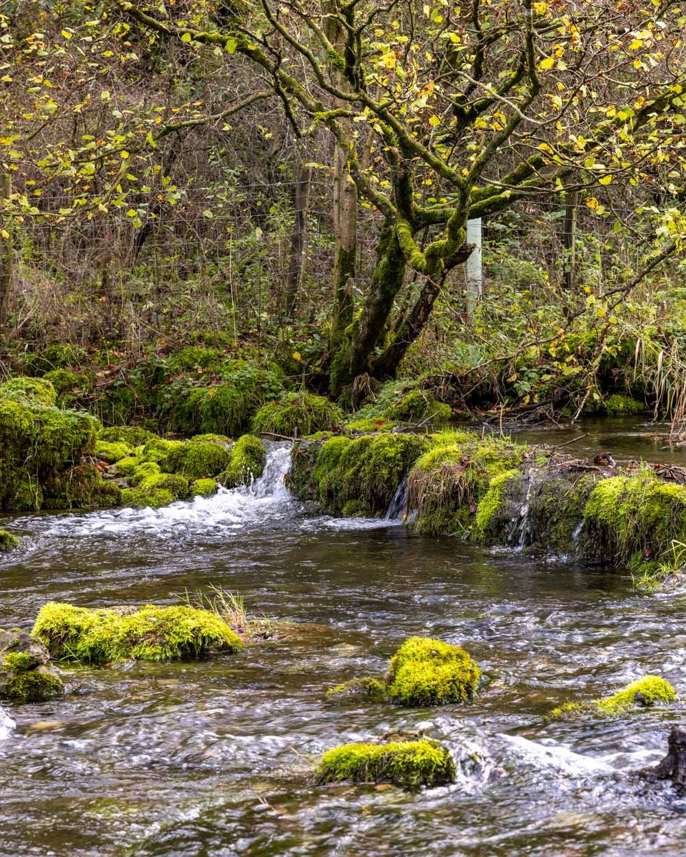
It was so quiet and peaceful through this section, with a huge amount of birdsong and plenty of moss covered trees which shone a vivid green in the afternoon sunlight.
Through the limestone cliffs
After you’ve been walking for 1km you’ll come to a little gap in the wall and head into the most impressive part of the gorge.
Although the gorge does widen here, the cliff walls are much taller and a striking silvery colour on a sunny day. The narrow flat path takes you inbetween the walls in what is the most dramatic stretch of the walk.
Roughly 1.1km from when this section began (2.1km/1.3 miles into the trail) you’ll come to a bridge. Don’t cross, and instead continue straight on, this is where you begin walking beside the river.
You’ll find more mossy trees and even some vibrant mossy rocks inside the river, which was particularly picturesque.
Along the river to Lathkill Dale Waterfall
Just 400m beyond the bridge, you may encounter a section of track which the river has spilled out onto. There’s an easy path slightly higher up the river bank, which helps you avoid wet boots.
You’ll then continue alongside the river, which is really relaxing, and various cascades offer a soothing soundtrack to the trail.
Once you’ve been walking for just under 3km (1.8 miles) you’ll reach Lathkill Dale waterfall. It’s by no means one of the biggest in the Peaks, but it’s very pretty, with multiple cascades and backed by a steep wooded hillside.
It might look like a great spot for a paddle, but swimming is not permitted for people or dogs, due to the fragility of the ecosystem here. There are plenty of signs up to remind people.
If you want to shorten the walk, this is a good natural turning point, however it does miss some of the fun mining ruins you’ll find further up the track.
Into the woodland
After passing the waterfall, you’ll see several more cascades and one of the old millstones (300m beyond the falls) before heading through a gate into a lovely stretch of woodland.
The woodland is gorgeous, but would be even better in October, when you’d get to experience all the beautiful autumn foliage. We were a little too late and almost all the leaves had already dropped, but it was still very pretty.
Approximately 1.4km from the waterfall (4.4km/2.7 miles into the track) you’ll see a little bridge over the river. Cross the bridge and after just a minute you’ll see the ruins of Bateman’s House, a former lead mine worker.
You can have a little poke around the ruins before heading down the ladder (more like a very steep staircase) into the mine shaft. It feels like you’re descending into a well!
Once you’re down there you’ll find an information board and also a wind up light system which illuminates the water-filled mine shaft.
Granted there’s not much to see, but I still thought it was great that it had been left open and safe access enabled, as opposed to the majority of other shafts being barricaded off.
To the lead mine ruins
Once you’ve visited the mine shaft, you head back over the bridge and continue along the main path. You’ll pass two natural sinkholes, which don’t look overly impressive without water in them, but are apparently the only ones of their kind in the UK!
Just 400m beyond the sinkholes you’ll see a path leading off to the left. Just a minute down the path you’ll find the ruins of the oldest lead mine in Derbyshire, Mandale Mine.
It’s an atmospheric spot which is slowly being reclaimed by nature. If you didn’t know it was a lead mine you could easily mistaken it for something much more romantic.
If you walk up the steps beside the main ruin you’ll come to a fenced off mine and an info board about the Mandale Engine House.
From here you head back onto the main track and follow it past a couple of old mining tunnels. You can go inside, but the ceilings are very low and it’s a bit wet and muddy. Kids will no doubt love it though : )
The walk continues past the tunnels for a further 400m before you reach the gate that exits the dale, around 5.7km (3.5miles) into the track (this includes the various detours we made into the mine areas).
From here we recommend heading back the way you came. You could make a circuit using the road, but this is not a nice route.
You could also head back along the opposite side of the river, using the bridge just through the gate, but this is a longer route and does involve road walking too. We’ve detailed the loop version in the map at the top of this article.
Parking for the Lathkill Dale walk
There is no official car park for the Lathkill Dale walk using the route described above. However, there are plenty of lay-bys where cars can pull fully off the road beside the trailhead. We parked at these coordinates: 53.195131, -1.766261 on the B5055 just east of Monyash, postcode: DE45 1JH.
This is 10 minutes from Bakewell, 50 minutes from Sheffield and 30 minutes from Ashbourne.
This post may contain affiliate links, meaning at no additional cost to you, that we will earn a small commission if you click through and decide to make a purchase. This helps towards the costs of running our website. Thanks for your support.


