Bamford Edge is one of the best short walks in the Peak District. You’ll have a little climb at the start, but it doesn’t take long to get to the top and the views are more than worth it. It’s beautiful at any time of day, but it gets even more special if you head up for sunset; there’s plenty of time to walk down in the twilight, so it’s an easy sunset adventure.
Whilst Bamford Edge is very popular, the views extend all the way along the ridge, so there’s plenty of room to spread out and find your own secluded spot.
Here’s everything you need to know about the shortest walk up to Bamford Edge.
The Bamford Edge Walk
The stats
Distance: 1.8 miles (2.9km) circuit
Elevation gain: 130m
Difficulty: Easy
There are several different walks which take in Bamford Edge. In this guide we’re sharing the shortest, easiest version.
The walk along Bamford Edge is very exposed to the elements, so it’s ideal to visit on a day with low wind, however, this being the Peaks, that can be difficult!
The path holds up quite well after rain, but if it’s been especially wet or following snow melt, the path back down the hill could become slippery.
Starting the trail: the climb
From the parking area, which is actually just a lay-by, (details below) you climb over a stile and head straight into the countryside.
It is uphill from the off, but the first bit of the trail is the steepest, so know that it won’t last all the way to the top!
The dirt path is in pretty good condition, but it’s definitely not manicured in any way. After 210m you’ll reach a short rocky patch and after this the gradient slackens.
The trail continues uphill for a couple of hundred metres before it all but flattens, and then gently undulates for the next 430m.
There are further rocky patches, but nothing too difficult and it wasn’t slippery despite being a little damp.
The ledge photography spot
At the 830m mark, you’ll see a little trail heading slightly downhill on the left.
You follow this path for 170m which takes you to the start of Bamford Edge ridge, which is instantly recognisable by the huge pile of gritstone rocks (1km from the car park).
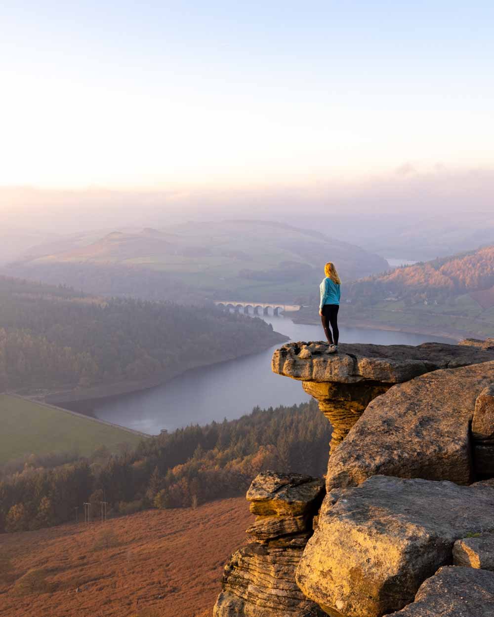
This is where you’ll find the most popular photography spot along the trail. It’s a huge overhanging rock overlooking Hope Valley. Depending on when you visit, there may be a little queue to take photos sitting on the ledge.
In terms of difficulty, it’s very easy to get onto the ledge, you can just step on it without having to climb any rocks.
It’s wide until near the tip, when it narrows significantly. It’s safest to shuffle along the last bit on your bum just to make sure you don’t slip.
It’s not actually that high when compared to how it looks in photos, but it’s definitely high enough that you do not want to risk a fall.
If you don’t like the look of it, or you simply couldn’t imagine queuing to take a photo, then there are many other great spots along the ridge - although none we saw had quite the same edge of the world feel, which is why this particular spot is so popular.
The ridge
From this first rocky outcrop you can continue along the ridge for more gorgeous views. This next part of the walk is entirely flat and the ridge looks directly out to where the sun sets.
There’s almost 500m of flat track and plenty of room to spread out and find a private sunset spot, or somewhere to have a picnic.
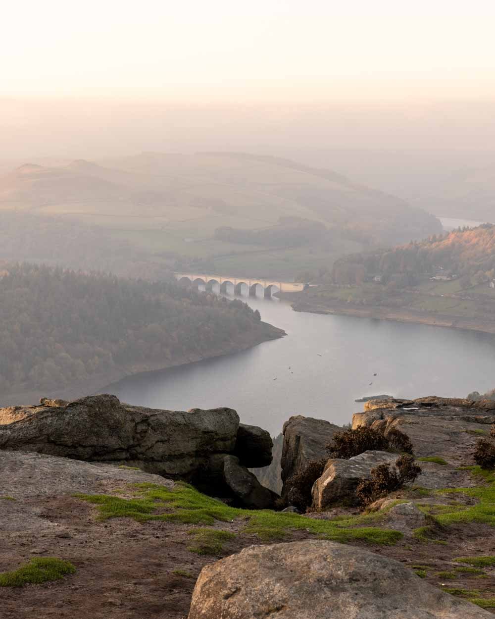
Our personal favourite views were 450m along the ridge where you will also get views of the Ashopton Viaduct and the Ladybower Reservoir.
The viaduct over the water looks especially picturesque from up high and it’s lovely to see both the reservoir and the rolling green hills.
It’s from here that you can get some more great edge of the world type shots using the jutting out rock. It’s actually nice and wide to stand on, but the drop is huge.
You don’t need to stand near the edge to get a good shot, it only looks that way in photos.
From here you could continue the trail making a much longer walk to Stanage Edge, but in our case that’s one for another time.
Heading back
To get to your car again you can take a slightly different route back. First head back along the ridge until you reach the first rocky outcrop with the ledge. Instead of then taking the path you came in on, take the path heading downhill ahead of you (slightly to the right).
This will circle back to your car through similar scenery. The path has one little rocky scrambly bit a few hundred metres in, but is otherwise similar to the trail you came in on. It’s steep for a little bit on a grassy or dirt track and then the gradient slackens considerably.
Roughly 450m into the descent you need to take the path on the left which will get you back to the lay-by after 500m.
Parking for the Bamford Edge walk
There is no official car park for this short version of the Bamford Edge walk, but you can park for free in the lay-bys near the trail head. They are located on New Road and the co-ordinates are 53.3520323, -1.6775186.
Parking is free and time is not limited, but it can get very busy. If visiting in peak periods it’s worth coming early or late to secure a space.
There are no facilities (including toilets) at the trailhead or along the walk, so please plan accordingly.
The trailhead is located just outside the village of Bamford, close to Hathersage. It’s just under a 30 minute drive from Bakewell, 30 minutes from Sheffield, and one hour from Ashbourne.
This post may contain affiliate links, meaning at no additional cost to you, that we will earn a small commission if you click through and decide to make a purchase. This helps towards the costs of running our website. Thanks for your support.


