Pindar Cave is one of the largest caves on the Central Coast; we’ve not yet seen or heard of one that’s bigger. To reach it you’ll need to head deep into the bush, on a track that is best accessed from the only train station in Australia that has no road access!
You’ll arrive to find the ginormous cave with its pretty sandstone walls and usually the remains of one or two recent campfires.
That’s right, if you come armed with all your gear and a sense of adventure, you can camp inside the cave and there’s room for a considerable number of tents to spread out!
Here’s what to expect on the walk to Pindar Cave.

The walk to Pindar Cave
The stats
Distance: 11.8km return, add 1km return for Pindar Falls
Elevation gain: 385m
Difficulty: Moderate
Trailhead: Wondabyne Train Station
Summary: The shortest route to Pindar Cave begins from Wondabyne train station and as mentioned, there is no road access (more on that next). From here you will begin on the Great North Walk, but then soon turn off onto an unsignposted track - though it’s relatively easy to follow and marked with intermittent cairns.
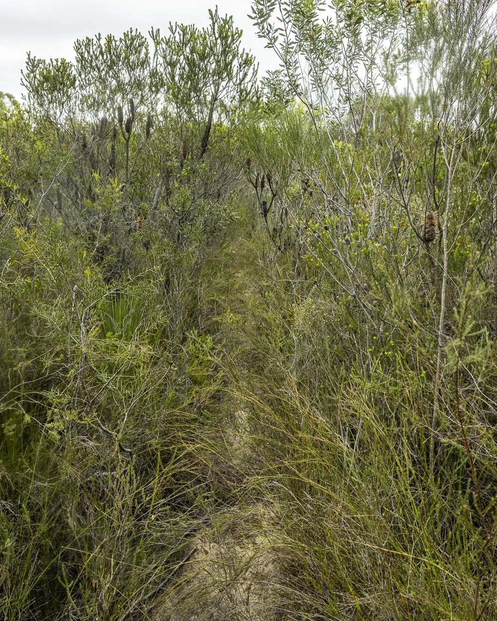
There are some ups and downs along the way, but no sustained climbs. The path is often overgrown at head and arm height and can get a little scratchy, but it’s not overgrown at foot level, so you can always see where you’re going.
There are a few rocky sections, but no scrambling required to reach the cave.
Planning the train journey to Wondabyne
The logistics of this trail mean that it needs a little planning before you set off. Wondabyne Station is on the Central Coast & Newcastle line (just make sure you don’t get on an express train as it won’t stop at Wondabyne) and there’s only 1-2 trains an hour. You can check the current timetable by clicking here.
If you live in Sydney, you can hop on at either Strathfield, Epping, Hornsby, Berowra, Cowan or Hawkesbury River.
If you plan to drive to a train station, then the closest options (one stop away) are either Hawkesbury River or Woy Woy, both of which are only a 10 minute journey from Wondabyne. The parking nearest to Hawkesbury River Station only allows you to stay for four hours (the restrictions end at 6pm). There are spots without restrictions, but they can fill up quickly.
Parking near the station in Woy Woy did not have restrictions, but again can fill up quickly.

Catching the train
Once you are on the right platform, walk to the far end of the carriages (the back of the train) and when the train pulls in, ask the attendant to stop at Wondabyne Station as it is not a scheduled stop.
It’s also worth noting when looking at the timetable that express trains will not stop at Wondabyne even if you ask.
You then need to sit in the last carriage as the platform is so short that this is the only point you can exit the train. The train journey is very pretty and follows the water most of the way.

On your return you need to flag down the train driver - which I was slightly apprehensive about, but it’s actually a seamless process! We did notice when waiting a loooong time for the train to Hawkesbury River that the trains going to Woy Woy were much more frequent, so you may want to bear that in mind when planning your trip.
There are toilets at Woy Woy and Hawkesbury River stations, but no toilets at Wondabyne.
Starting the trail: along the Great North Walk
From Wondabyne station you head left and onto the narrow trail that starts as a grassy path and then turns into a bush track, which is part of the Great North Walk.
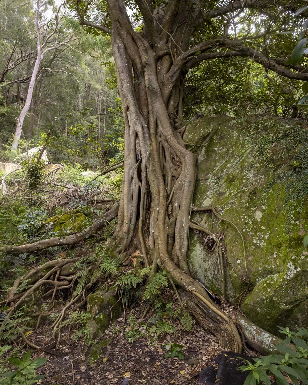
You’ll pass an amazing fig tree and small boulder cave before you quickly begin heading uphill. The first couple of hundred metres are quite steep but on a decent track.
It’s mainly stairs but there are some bits of rocky and uneven terrain too.

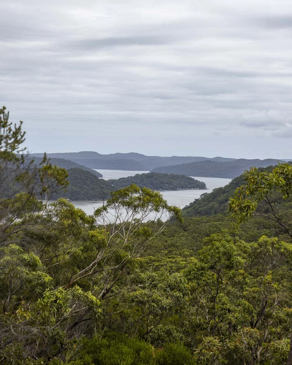
At the 250m mark the path will briefly flatten and you’ll get some nice water views and soon spot the quarry, which was opened in 1922 to produce sandstone.
The bush is also stunning along this part of the track, it’s my favourite section of the whole walk.

You’ll have another couple of hundreds metres of climbing to do before you leave the bush track and reach a fire trail.


Along the fire trail and finding the track to Pindar Cave
The next kilometre is all on a fire trail. It’s wide and though it does go uphill for the majority of the time, it also has a few flat sections. Only one very short section is steep.
On the way back we saw a couple of wallabies along this stretch so keep an eye out!
At approximately the 1.55km mark you need to look out for a rock platform on your left. This marks the turn off the fire trail towards the cave.
It begins as a good compact sandy/gravel trail and then narrows to a bush track a few hundred metres later.


At the 2km mark it gets a lot bushier and 50m later you’ll see a pink ribbon tied to a tree, guiding you right. From here the trail is more rustic all the way to the cave.

Through the bush
Though much of the track is now a worn dirt path, there are some rocky sections, though no scrambling is required. It is generally quite uneven underfoot for much of the way.
The path is overgrown in sections, rarely at foot level, but you need to watch your head and arms to make sure you don’t get scratched!
This next section of the walk is mainly flat, with a few minor ups and downs. You do get some breaks from the overgrown path, but it will appear again as you continue on.
At just over 3.2km into the track you’ll come out to a rock platform. Cairns mark your way almost immediately back into the bush and this will happen a couple of times in quick succession.

At the 3.9km mark there’s a little bit of a view out over the bush, which makes a change as the rest of the track is fairly well enclosed.
You’ll then have a very brief rocky uphill section before you hit a nice long flat stretch, which is not overgrown and offers much more pleasant walking.

Roughly 5km in you’ll reach another rock platform and cross it to find the path heading left, back into the bush.
Approximately 100m later you’ll reach Mount Pindar Lookout, which offers a view over the bush with distant water glimpses. It was more than a little gloomy when we passed by but still pretty.

There are a couple of rocks to climb down to get onto the next part of the track and again plenty of cairns pointing the way.
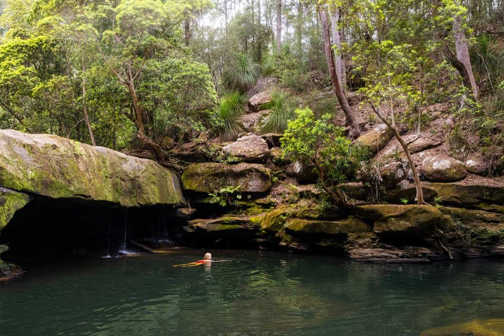
The next section is less overgrown than some of the earlier track and relatively flat and easy. You’ll reach Pindar Pool after 700m, though it’s small and was quite laden with debris, so I declined a dip!


You’re now just 300m from the cave. The last few metres are rocky, but still easy enough and then you’ll reach the huge gaping mouth of Pindar Cave.

Reaching Pindar Cave
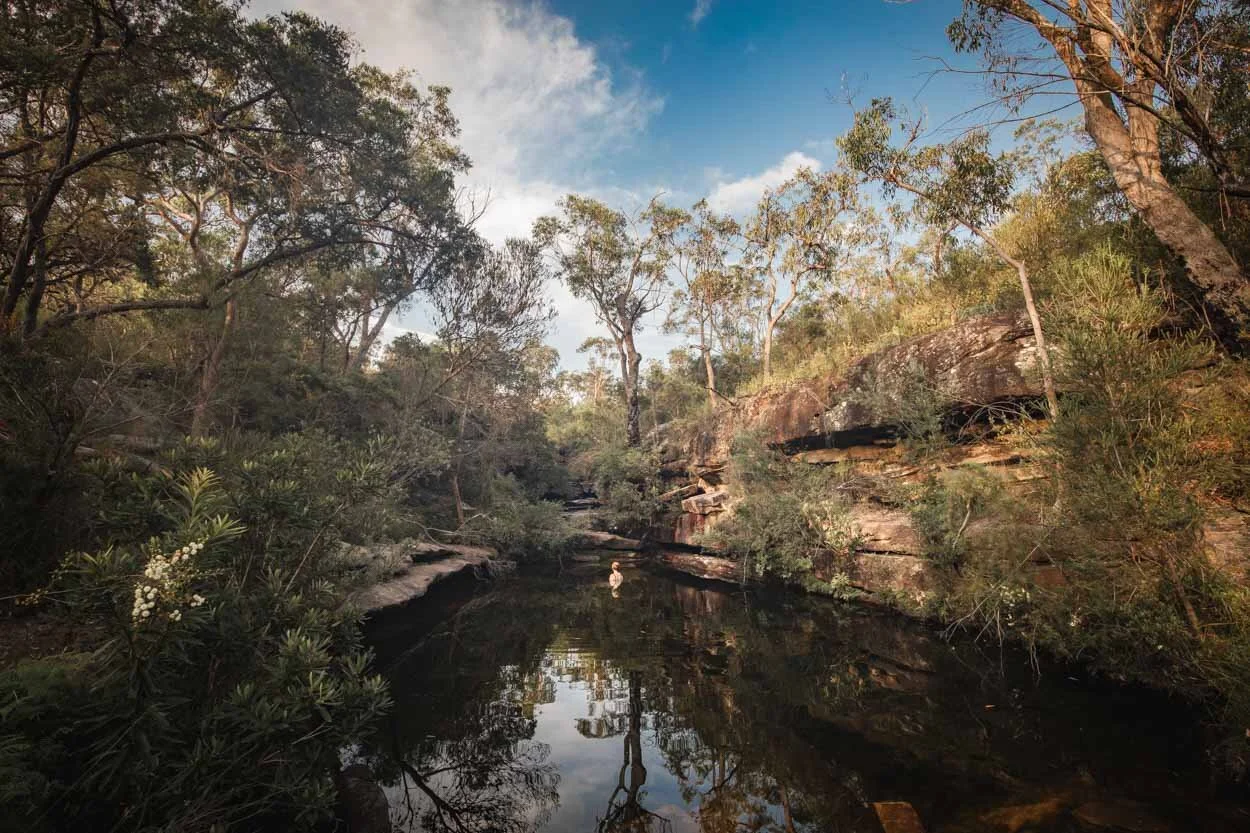
Pindar Cave is huge, the internet tells me it’s 50m long, though it felt bigger, so I wish I’d measured it! The start and end of the walls are quite shallow, but the middle section makes it deep enough for plenty of tents to be sheltered from the elements.

The floor is sandy and we could still smell the remains of a couple of recent campfires which added to the atmosphere.
The cave walls don’t feel as steep as Mega Cave, but the length of the cave makes it dramatic. We made a day time visit, but I can imagine it would be an atmospheric spot to camp.


On that note we visited in the school summer holidays and a couple of people had been camping the night before, I imagine it’s the same on warm weekends, so for a more solitary experience, you might want to pick midweek or a Sunday night.

To Pindar Falls
If you want to extend the walk a little you can head on through the bush for 500m to Pindar Falls. The path leads away roughly from the middle-ish part of Pindar Cave - it’s very worn and easy to follow, so if you don’t feel like you’re on a proper track then you haven’t found it yet.
It’s pretty flat and easy and not too overgrown. You’ll pass over a small cascade just before you arrive at the top of Pindar Falls.

For us, even after some recent rain the flow was very low. There was a decent enough cascade to paddle your feet in, but when we peered down over the rock platform to view the main falls below there was barely a trickle of water.

For this reason we didn’t look for the track leading to the bottom of the falls as there would have been nothing to see! I imagine this is the case most of the time, as even the recent rain we’d had wasn’t enough to fill it.


After visiting the falls you retrace your steps back to the cave and then on to the train station again. You can make a much longer walk by heading to Kariong Brook Falls and ending at Woy Woy, but it’s a much bigger day.
Keep them wild
Please remember to take all rubbish with you and keep these places wild and pristine - as with anywhere in the outdoors. It’s important to leave them exactly as you found them so they will remain beautiful for generations to come.
Litter tends to breed litter, so if you do spot any and are able to pick it up and dispose of it outside the national park, it will go a long way to keeping the area clean.
This post may contain affiliate links, meaning at no additional cost to you, that we will earn a small commission if you click through and decide to make a purchase. This helps towards the costs of running our website. Thanks for your support.