If you’re looking for a walk in the Blue Mountains that’s relatively easy but doesn’t sacrifice on the views, then Lockleys Pylon is a great choice.
It’s in a quieter part of the national park and tends to see a lot more local visitors than it does travellers. You’re likely to get huge swathes of the track all to yourself!
Whilst the beginning of the walk is not going to blow you away, the last kilometre is simply spectacular. If you have a little more energy to spare, we recommend heading on to Du Faur Head to get to one of the best views in the Blue Mountains. It’s one that we’ve never seen anyone else at!
Here’s what to expect from the trail.
The Lockleys Pylon walking track
The stats
Distance: 7.2 km return (8.5km if you add Du Faur Head)
Elevation: 176m
Difficulty: Moderate
Type of trail: Return
The Lockleys Pylon walk is a moderate hike. It undulates, but isn’t ever very steep (unless you add on the trail to Du Faur Head).
You can walk the Lockleys Pylon trail (including the side trail to Du Faur Head) in 2 - 2.5 hours.
Starting the trail
The start of the trail to Lockleys Pylon isn’t going to win any awards, but it is worth persevering through to the ridge and the amazing views from the top.
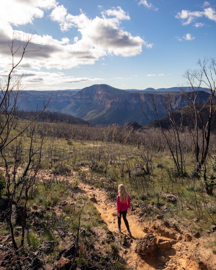
The first couple of hundred metres of the track is uphill and narrow, before it flattens out. The path is lined on both sides with bushland which used to be quite dense, but is now very charred after the huge bushfires of 2020.
There are already some signs of regeneration, so it will be a nicer section of the track again in years to come. You’ll get the occasional peek between the trees to the mountains beyond, but it takes a while to reach the truly open views.
It’s worth noting that the path is quite rocky (which is a running theme with the walks along the Mount Hay Road), so although it’s never difficult you do have to watch your feet a bit.
After around a kilometre on undulating trail, you’ll reach a patch of forest which is much more burnt out than the earlier stretch. There are quite a few trees which are just black, burnt remains.
Although it’s pretty sad to see, you can look to the mountains beyond which are still green and well forested which definitely helps.
It’s not the most exciting section of the walk but it is leading you to a big pay off at the end.
On to the ridge
You now have roughly 1km before you get to the really good bit of the walk.
This part of the trail is a contrast: you’ll see sections that have been decimated by the fires, but other parts have remained intact and are still green. The one thing we know about the bush in Australia is that it bounces back quickly.
The trail has gentle ups and downs, but it is never steep, and the only thing that stops it being a complete breeze is the rocky terrain.
When you are 2.5km into the walk the views begin, and they are the reason to do this is a really worthwhile trail.
The mountain views on both sides are spectacular and because the trail is so quiet, you usually get them all to yourself!
Although it hasn’t taken long to get there, and the trail isn’t difficult, you feel like you’ve come out into the wilds.
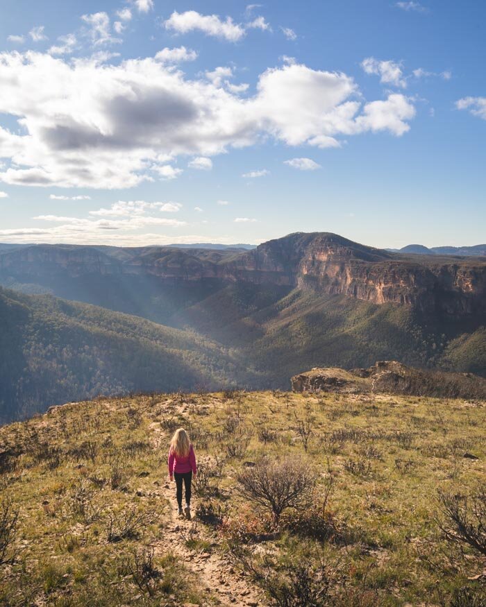
After a couple of hundred metres you round a corner and then see a gorgeous ridgeline and the route up to the top of Lockleys Pylon.
It’s a really photogenic part of the walk and the one I still had etched in my memory from the first time we did this walk around five years ago.
Heading up to Lockleys Pylon
The last kilometre of this walk has jaw dropping views all the way and the bushland disappears, leaving it completely open.
Watch out for the wind on the ridge though, even though we didn’t feel as much as a gentle breeze up to this point, on the ridge itself the wind was howling, and nearly knocked me off my feet!
As soon as you begin the climb up Lockleys the wind mercifully disappears!
If you’re lucky enough to be on the ridge without the wind, it’s the loveliest part of the walk and definitely a chance to get some great photos.
The final climb up the little hill that is Lockleys Pylon is quite short and gentle. We always take the path on the left-hand side and it only takes around ten minutes, including photo stops!
It’s a narrow path but it never feels precarious in any way.
Once at the top you’ll reach the huge cairn and panoramic views of Mount Hay, Mount Banks and the Grose Valley.
The top of Lockleys Pylon is pretty big and there are lots of rocks to sit on so it’s a great picnic spot in good conditions.
If you are up for another two kilometres return and you’re keen for another big view then we highly recommend taking the side trail to Du Faur Head.
Finishing the walk and the side trail to Du Faur Head
Just to warn you it’s only 1km each way to Du Faur Head, however, there is a steep climb back up. It’s well worth it though!
This part of the walk is not signposted, so you’ll need to look out for the path. To find the beginning of the trail to Du Faur Head, continue over Lockleys Pylon (beyond the cairn).
The trail heads fairly steeply downhill and feels more uneven than any other part of the walk - but that might be because I am not great at heading downhill on rocky terrain! You take this path regardless of whether you want to return to the car park or if you want to go to the next lookout.
Once you’re down from Lockleys Pylon (which takes no time at all) turn left for Du Faur Head. If you want to go back to the car park, turn right and you’re back on the path you have already walked.
If you took the left to Du Faur Head, you’ll soon come to a long staircase. Take the stairs all the way down to the bottom - nice and easy on the way and a bit of a puff on the way back!
You then follow the little dirt path around and up on to the escarpment. You then have around 400m walking along the rocky ledges before reaching Du Faur Head itself.
There doesn’t really appear to be a path as such, you just follow whichever route feels easiest to you.
I wouldn’t call it a scramble, but it does involve climbing a few rocks. The views are incredible throughout this section, culminating in the huge vista from the lookout itself.
You are completely surrounded by mountains and can see all the way into the Grose Valley. It feels really remote here and the only sounds were those of the birds.
The mountains somehow feel closer than they do on Lockleys Pylon and it’s a mesmerising spot to just sit and take it all in.
You can continue the walk all the way down to the Blue Gum Forest.
If you are interested in making this a mega walk, just bear in mind that heading all the way into the Grose Valley will become an all day affair, so you will need to have started early!
Heading back
From Du Faur Head you retrace your steps, and it’s fairly steep on the way back up until you reach the junction with Lockleys Pylon. From there you have some uphill to go, along the undulating trail but it’s never very steep. If you’re looking for more great walks in the Blue Mountains, check out our detailed guide.
Packing suggestions for the walk
Having the right gear can make a huge difference. Here’s what we pack and have relied upon for years:
Sunscreen: Cancer Council Active. With a high SPF, but not the greasy feel of other sunscreens. Makes a big difference when you’re working up a sweat on a sunny day! Check it out on Amazon
Good Rain Jacket: North Face This is an essential item we always pack in our bag! This jacket from North Face is designed to keep you dry but also comfortably warm (many rain jackets will make you feel like you’re in a sauna). Check it out on Amazon
Day Pack: Osprey Talon 22 (we’ve owned this for years). Check on Amazon or direct with Osprey
Hiking Boots: Merrell Moab (for men and women). We’ve both used these for over three years and they just keep going. Check them out on Amazon
Trekking poles: We’ve used Black Diamond for years as they are light, solid and durable. Check them out on Amazon.
Reusable water bottle: To avoid single-use plastic. Check them out on Amazon
Essential information about the Lockleys Pylon walk
Parking for the walk
There is very limited parking for Lockleys Pylon with only few official spaces by the trailhead. If these spaces are taken, then it’s wherever you can squeeze your car in at the side of the road.
It shouldn’t be an issue any time other than a busy weekend.
The Mount Hay Road
The Mount Hay Road has been labelled one of the worst in all the Blue Mountains. However, that’s not always the case! It’s a dirt road which can be good if it has been regraded (something that doesn’t happen that often).
We’ve tried and turned back before due to ginormous pot holes and ridges that are only suitable for high clearance vehicles, but we’ve also managed in a small car at other times - just after the road has been regraded.
It’s worth checking conditions ahead of time if you’re coming without a high clearance vehicle.
Public transport for the walk
Unfortunately the walk is not accessible by public transport. The nearest train station is Leura but that’s still 12km away and there are no buses. Depending on the condition of the road I’m not even sure a taxi would want to do it.
Park fees
There are no park fees or vehicle entry fees for any of the walks on the Mount Hay Road.
This post may contain affiliate links, meaning at no additional cost to you, that we will earn a small commission if you click through and decide to make a purchase. This helps towards the costs of running our website. Thanks for your support.
Like it? Pin it!
Follow us on Social Media
Are you planning on doing the hike to Lockleys Pylon? What’s you favourite walk in the Blue Mountains? Let us know in the comments below!


