The Fortress Creek infinity pool is perched at the top of Fortress Creek Falls and overlooks the spectacular Grose Valley. The scene is so picturesque that it’s become one of the most coveted swim spots in the Blue Mountains, well, plunge spots at any rate, as there definitely isn’t room to swim!
Despite its popularity, this is not an easy spot to reach and does require negotiating a couple of scrambles.
In this guide we’re sharing exactly how to find the pools, as well as what to expect from the trail.

The Fortress Ridge Infinity Pool Track
The stats
Distance: 9.2km return
Elevation gain: 488m
Difficulty: Moderate
Trailhead: Fortress Ridge Car Park, Mt Hay Road in Leura
Summary: The first 3.6km of the walk to the infinity pool is all on the Fortress Ridge Track, which is maintained and generally in very good condition.
There are a few ups and downs, but no steep sections along this part of the walk. The final kilometre is off track, though for much of the way there is a worn path.
The worn path - despite descending steeply at times - is in decent shape and relatively easy. However, there are some sections with loose soil which can be slippery whether wet or dry.
There is one bit in particular which is steep and loose, and there isn’t much in the way of surrounding trees to use for support.
There is also a muddy down climb just before you reach the creek, but this has very sturdy tree roots which makes it easy enough.
The very last bit to the top of the falls requires climbing through a small boulder cavern which has tiered rocks to use to get down.
It’s a little awkward when you have to climb up this bit as you have to turn sideways due to the angle of the rocks.
The pools themselves are very easy to get into in dry conditions, but would be more slippery and potentially dangerous when the creek is in full flow.
Fortress Creek Infinity Pool - safety warning
The Fortress Creek Infinity Pool sits on top of a huge waterfall that cascades over a sheer drop, straight down into the valley 70m below. A slip near the edge would be fatal. The rock around the pools is generally grippy enough when dry, but slippery when wet.
This is an adventure best saved for a dry period. When dry - as you can see in our photos - there is very little water coming over the top of the falls and therefore a large amount of the rock is bone dry and makes exploring easy.

When in full flow, much of this area would have water running over it and therefore become more slippery. The force of the water in the pools could also push you over the edge.
When dry it’s a fun spot and if you keep back from the edge, poses little risk. After significant rainfall, I honestly wouldn’t visit; you want to enjoy the pools, not feel like you’re holding on for dear life.
You can’t see the waterfall from the top or at any point along the trail, so if there is just a trickle of water it doesn’t make any part of this experience less scenic.

Avoiding the crowds
In recent times, the Fortress Creek Infinity Pool has become very popular. On hot days it gets busy and even on cooler days still sees a trickle of visitors.
As there are only three tiny pools, we wouldn’t recommend visiting if you think there are more than a few people there (there’s nothing more frustrating than walking for over an hour to find all the spots are taken).
To truly enjoy it, we recommend avoiding peak times - the middle of the day, weekends and public holidays are likely to attract the crowds. Ideally, you’d want to visit mid-week, but if you can’t then try to go early or late.
We visited at 10am midweek in September and had it to ourselves for a couple of hours. However, on the hike back we passed a few groups who were on their way to the pools.

Starting the trail: the Fortress Ridge Fire Trail
You begin the walk from the locked gate at the start of the Fortress Ridge Fire Trail. It’s a rocky track, but not loose and slippery, you just have to watch your footing so you don’t roll an ankle.
The majority of the fire trail is relatively flat, though there are some ups and downs along the way.


The track is not signposted, so watch for the junction at the 600m mark. You need to turn right here, though the more obvious and wider track continues left (this is the path that will eventually lead to Dr Dark’s Cave, a fun side trail if you have the time).
The path is still flat with undulations and the conditions are similar to the first part of the fire trail, though it’s narrower and starts to feel more bushy.

The bush track to Fortress Ridge
At the 1.4km mark you will reach a junction and see a small cairn beside the path on the left. Take this rocky path and follow it uphill.
You’ll see a prominent rock feature ahead and the path appears to split in two, in reality both join up at the top behind the rock.

As you continue the path becomes narrow and sandy and you’ll start to get some great views of the mountains. You’ll then climb up and then down a small hump. The path is rocky, but not slippery and the climb and descent is very short.

Just over 1.9km into the track you’ll come to a small rock platform and you need to turn left here. There are two paths to the left, follow the first one, slightly set back from the cliff edge.
You’ll then have another short descent before a long flat section on a sandy path through the bush. This lasts around 500m and you’ll get the occasional peek out to the mountains between the gaps in the trees.


The path will then ascend gently for 150m before briefly flattening and then climbing more steeply at the 2.95km mark. This steep climb only lasts for 80m and the path is rocky but not slippery.
You’ll then descend this small hump and get your first views of the mountains you’ll see from the infinity pool.

The track continues in much the same vein until you reach a junction at the 3.6km mark - the exact co-ordinates for this turn are -33.6359924, 150.3461503. It’s at this point you can choose to go to the viewpoint (straight) or down to the infinity pool (right).
A quick detour to Fortress Ridge
From this junction you can make a short (150m each way) detour to Fortress Ridge. This is one of the best views in the Blue Mountains and well worth the quick detour.
The path to the ridge is straight on and when it splits you can either take the path ahead - which leads up and over the pagoda to the main view - or follow the path to the right, which is a normal track and doesn’t involve climbing the pagoda.

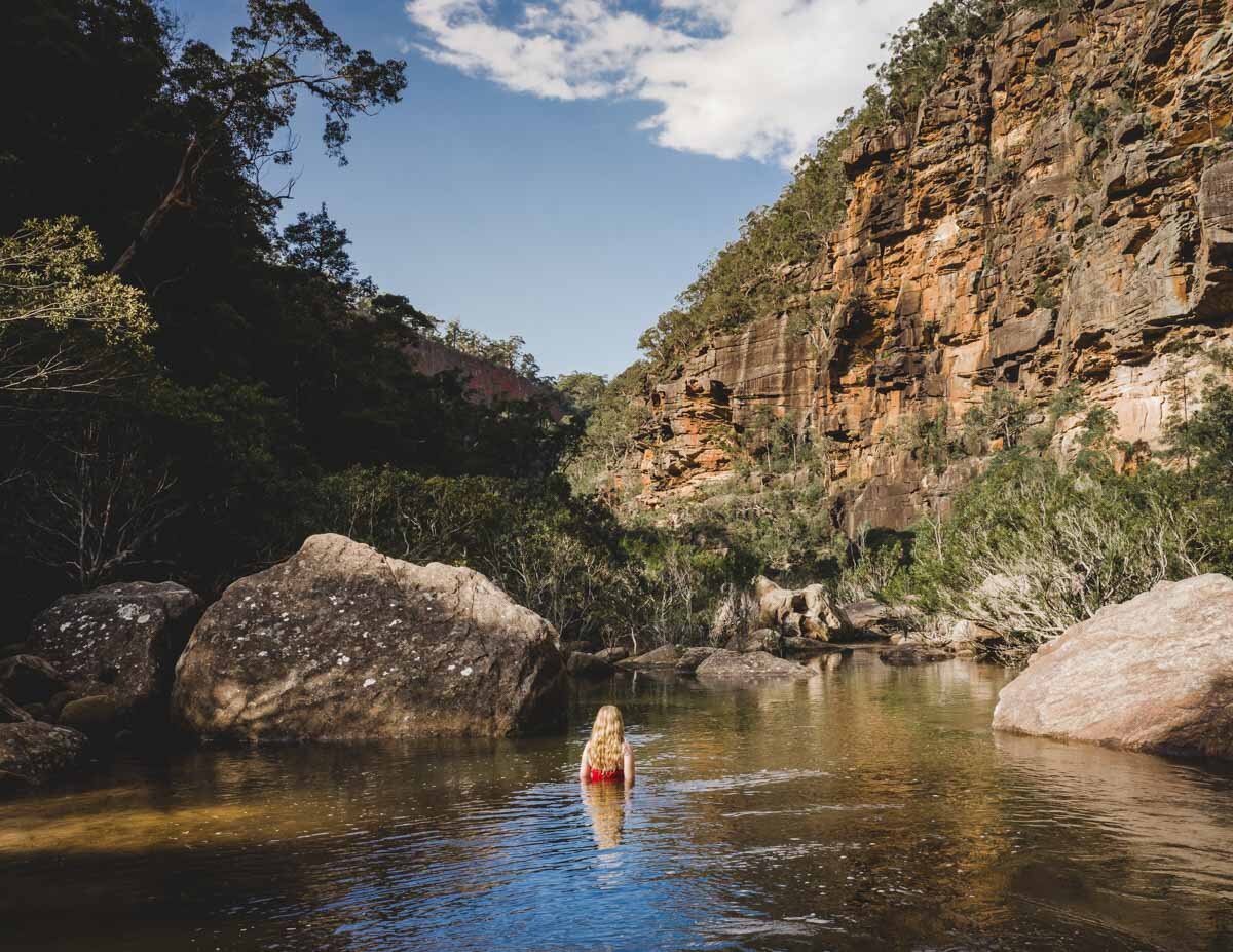
The view from the rock platform is stunning, looking out over Lockleys Pylon, Mount Banks and the Grose Valley. There’s enough space to sit and relax and it would make a great picnic spot.
If you’re visiting the pools early in the morning, we’d recommend heading to Fortress Ridge afterwards as it doesn’t get busy like the infinity pool does.

Starting the off track walk to the infinity pool
At the junction at the 3.6km mark, you need to turn right to reach the infinity pool. A couple of metres later the path forks again and you will also turn right here.
The next 10m or so are rocky, but the descent is easy. You’ll then come to a large cliff wall and a warning sign (stating the track is rough etc).


The path is easy to follow and well worn. It’s either flat or a very gentle descent for the next 200m. Tiny bits are a little overgrown, but still easy to follow.
You’ll emerge to a great view of Lockleys Pylon after 200m. From here the path heads more noticeably downhill and is rocky, but still easy enough and not dissimilar to much of the Fortress Ridge Track you’ve already walked.

At the 4.1km mark, or 500m after turning off the Fortress Ridge Track the path bends right and 30m later you will reach a much steeper, looser part of the descent.
There are actually two paths you can take, though they both join up after a few metres.

The more obvious path will bring you out to a section which looks like you need to traverse a few steps across a narrow part of the cliff before descending.
Though I am sure many people do this, the easier path can be found by heading a few steps uphill to the left and walking behind this section and over to the pagoda on the other side of the traverse.
The traverse

The traverse
This misses the narrow section and a few steps of the steep loose descent, and is the better option in my opinion.
From here you will have roughly 50m on a steep loose path. There aren’t many trees for handholds, but small rocks in the soil help a bit with footing. It is a little slippery, but ok when you take care with footing.

After this the path continues descending but is more like a normal rough bush track and is much less steep than that 50m section.
There is a very short - few steps - on a very loose sandy gully, but then it’s either a worn dirt path, or a little rocky. The trail is always easy to follow.

Roughly 200m after the steep loose section, you’ll come to another steep bit. It’s a bit muddy here, but there are sturdy tree roots all the way down and deep footholds within the dirt path.
This means that though it looks steep and slippery, it’s actually not too bad as the tree roots are available along the whole descent.

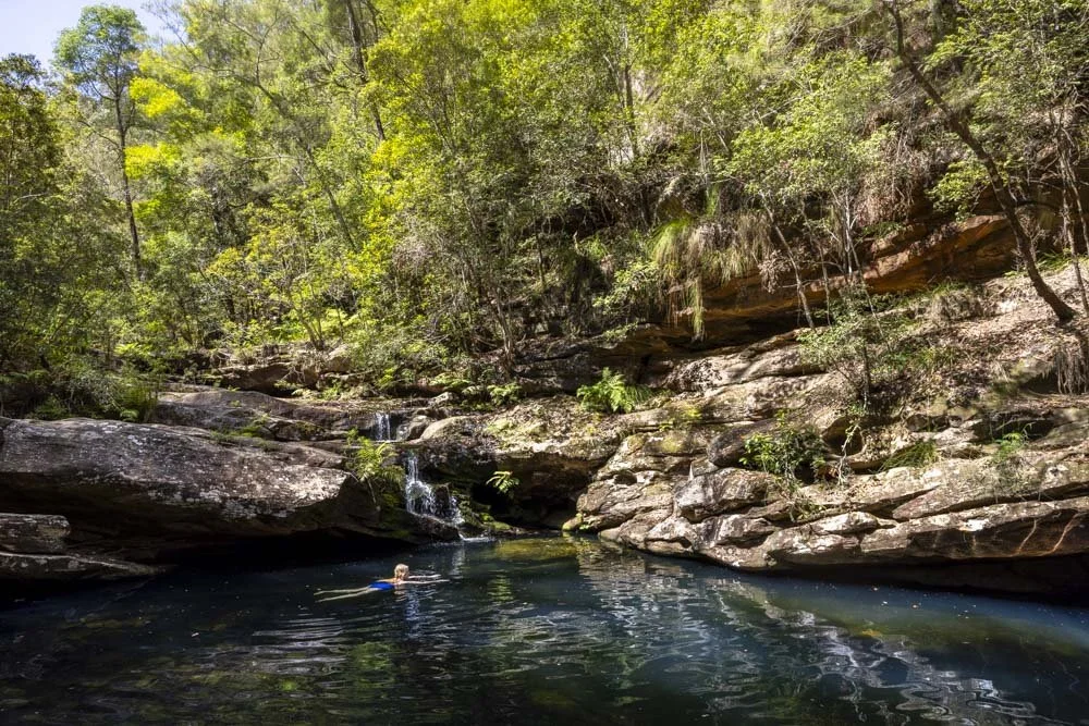
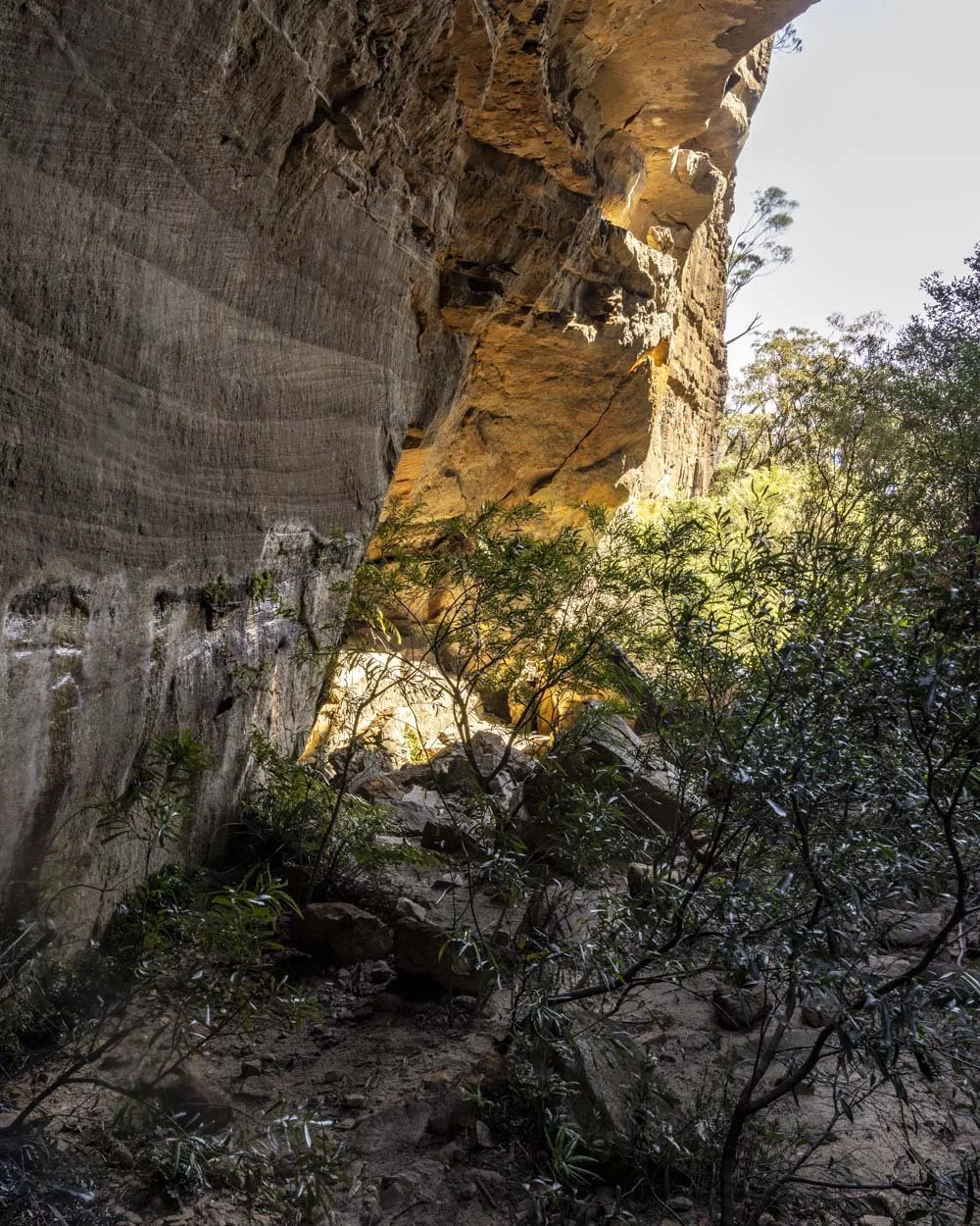
Reaching Fortress Creek Canyon
At this point you will have reached Fortress Creek Canyon, when the dusty/mud track becomes rocky. From here you’ll want to turn left and hug the left canyon wall as you head downstream. At this point you’ll need to clamber down a big rock.
You can go down the left or right side, but the left is easy in my opinion as you can just step to the edge of the rock and then sit down and your legs should roughly reach the ground.

From here, it’s just a few metres straight on or slightly left towards the cliff wall. You’ll see a large yellow arrow pointing towards a small boulder cavern.
Climb down through the boulder cavern and into the creek.

We assumed we’d now be walking through the creek and therefore didn’t remove our boots, but these few steps are the only ones in water (unless you’re visiting during a wet period), so you may want to remove your shoes to avoid squelchy boots for the rest of the walk.


There are several ledges which make it easier to climb down, though the rock is slanted, so it’s slightly awkward - more so on the way back up.
From here you have less than 100m to the infinity pools. There’s a bit of rock hopping, but it’s easy enough. You’ll soon see the edge of the falls and the small pools ahead of you (4.6km from the car park).

The Fortress Ridge Infinity Pool
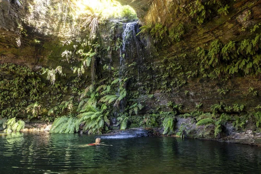
There’s actually a couple of little pools on the edge of the cliff above Fortress Creek Falls, but one is slightly bigger and also safer for a dip. It’s the one on the left, which during dry periods has very little flow and a higher wall around it than the one to the right.

The bottom of the pool is full of small pebbles, so it’s not slippery, in contrast to the pool on the right which has a flat rocky bottom and is quite slippery.
Both pools are very picturesque, offering sublime views over the mountains. They are however, tiny, so they really are only good for one or two people to have a dip. If you’re planning a weekend trip in the warmer months and are crowd averse then you’ll probably want to go early in the day.

There is a third pool behind the middle one, but it’s even smaller than the other two!
Whilst the water is cold, this area is a little sun trap, so on a warm day it’s refreshing and not freezing. If you can, pick a day with low wind as you will really feel it up here and it also blows the water from the falls back over the pools too.
There’s plenty of room on the rock platform behind the pools to relax in the sunshine, so you can easily while away some time dipping in and out of the pool and warming up on the rocks inbetween.

The walk back
The walk back up to the Fortress Ridge Track is easier in some ways, as you never feel like you’ll slip going uphill. However, in just 1km the track climbs 200m in elevation, with the steepest section ascending 100m over just 350m.
This makes for a stiff climb and there is little shade, in the height of summer, that’s going to feel tough.

Other than the elevation the only bit of the walk that felt trickier on the way back for me was climbing up the slanted rocks in the boulder cavern.
Due to the slant it felt a bit awkward and a bit more so due to having wet boots (which also dripped on the rock), which made it feel less secure. Otherwise, the walk back is straightforward.

Keep them wild
Please remember to take all rubbish with you and keep these places wild and pristine - as with anywhere in the outdoors. It’s important to leave them exactly as you found them so they will remain beautiful for generations to come.
Litter tends to breed litter, so if you do spot any and are able to pick it up and dispose of it outside the national park, it will go a long way to keeping the area clean.
There are no facilities at the trailhead for the walk or anywhere along the trail so please plan accordingly.
Getting to the Fortress Ridge Infinity Pool Track
There is a car park before the locked gate for the Fortress Ridge trail, it’s small, but we’ve always found a spot even in peak periods.
The car park is 8km down Mount Hay Road and about 25 minutes from Katoomba and 1 hour 45 from the centre of Sydney. The last 6km of the road are gravel.
It tends to be in good condition, but after wet weather can deteriorate and become potholed until the road is next graded. Having said this, unless there is dire degradation of the road, it’s suitable for any vehicle.
This post may contain affiliate links, meaning at no additional cost to you, that we will earn a small commission if you click through and decide to make a purchase. This helps towards the costs of running our website. Thanks for your support.