

In a park famous for its crazy rock formations, the walk to Castle Rock, Turtle Rock and The Sphinx showcases some of the best you’ll find in the area. Although visiting each of the granite monoliths is relatively easy, you can make your own adventure by scrambling up the rocks and boulders. If you want to reach the very top of Castle Rock you’ll have to climb a short distance on a steep rockface, not dissimilar to climbing the nearby Pyramid.
However, to see the rocks and enjoy the views doesn’t really involve scrambling, so you can still do this walk if you’re after something a little less challenging.

The Castle Rock, Turtle Rock and Sphinx Track
The stats
Distance: 5.4 km return to the Castle, or 9.1km return to visit all three rocks
Elevation gain: 250m to Castle Rock, 400m to all three rocks
Difficulty: Moderate
Trailhead: Girraween Day Use Area - exact spot here
Summary: The walk to Turtle Rock and The Sphinx is all on a well maintained bush track and does not involve scrambling. To reach the top of Castle Rock requires walking up a steep granite rockface and you need to pick a dry day for this one so that the rock is grippy.
This part of the track will be unnerving if you have a fear of heights or exposure. However, you don’t need to go to the top to get some incredible views.
The rest of the trail is very well maintained and though there are some climbs, aside from Castle Rock, it’s on good staircases or dirt tracks. You can do additional scrambling around Turtle Rock and the Sphinx, but this is optional.
If you want a longer walk you could also add on the much more challenging Mount Norman track which branches off from The Castle 2.1km into the walk.
Starting the trail: through the bush
The official trail begins at the Girraween day use area, though you could lose 1km from the overall distance mentioned in the stats above by starting at the Castle Rock campground (more details at the end of the post).
We’ll start this guide from the official trailhead, but if you don’t mind not completing the whole track, losing the extra 500m each way also means you miss climbing the first hill!
From the Girraween day use car park, cross to the opposite side of the road and look for the trail marker which takes you into the bush. It’s the next left turn after the fire trail and clearly signposted.

You’ll begin walking gently uphill on a good gravel path in a nice patch of bushland. Around 200m later the path gets a little uneven and you’ll also have some steps for the next 100m.

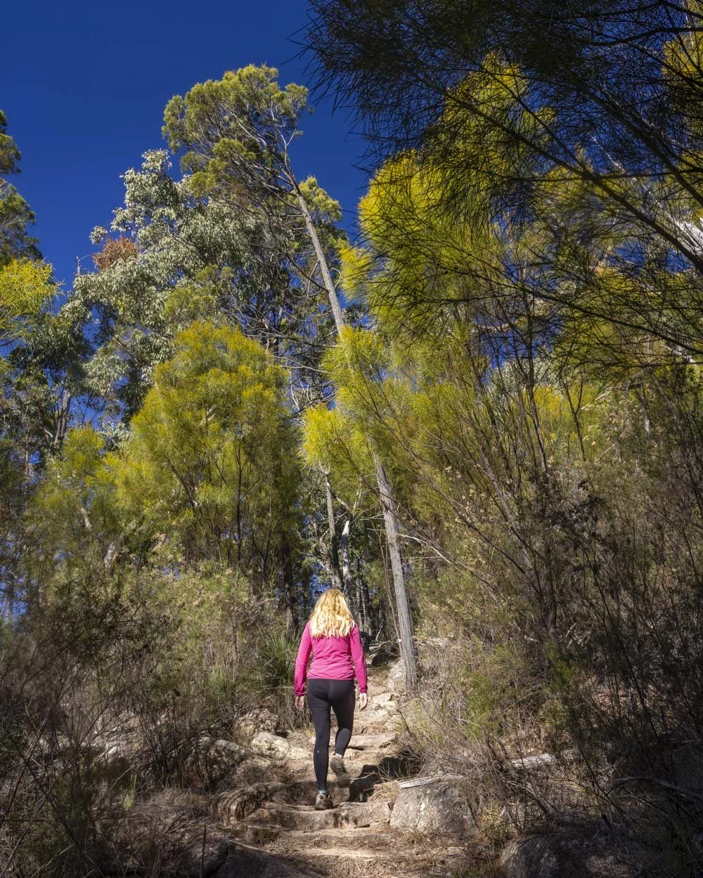
From here you’ll be walking beside some giant boulders and the path predominantly flattens. You’ll reach the junction with the campground at the 650m mark (the campground is 150m from the junction on a good gentle path).
From the junction you have some more climbing on stone step for the next few hundred metres. Though there are the odd very small downhill sections the majority of the way is uphill until the path flattens again just over 1.2km into the trail.
Following this the next 650m are mainly flat and the path is in excellent condition.

Reaching the base of Castle Rock
Approximately 1.9km into the walk you’ll reach a giant boulder and then follow the picturesque stone staircases uphill.
Roughly 150m later you’ll reach a junction and head left towards Castle Rock (it’s signposted).


There’s another junction 100m later and this is where the Castle Rock and Mount Norman tracks diverge.
Just 50m later you’ll reach a warning sign about the trail conditions, but it’s still a little way off being anything other than a normal bush track.
The path follows the side of the giant boulders uphill and it’s steepish in parts, but all on a good track.

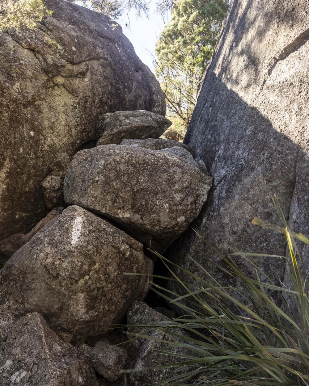
After another 150m climb you’ll reach a little scramble. It’s a big boulder you need to climb up which is grippy but slightly steep and curved. Whilst the rock is grippy it’s nowhere near as grippy as the granite on Castle Rock itself.

After climbing this boulder you’ll reach a crack inbetween two giant rock walls with a couple of huge boulders wedged on top. It’s very atmospheric and this is your route through to Castle Rock (2.4km from the car park).

Once you walk through the crevice you’ll reach a large wide granite surface with some truly incredible views. You look out to densely forested mountains which are dotted with the quintessential granite rocks synonymous with Girraween.

Climbing to the top of Castle Rock
The next section of track to reach the top of Castle Rock is quite different. The formed track is gone and you’re now following white dashes to mark your way along the granite. The first bit is a traverse along the rock towards the big boulder.
From here the ‘track’ gets much steeper and is quite exposed. The rock is really grippy (when dry), but I hadn’t realised the track was like this and I definitely lost my head for heights when moving around the boulder and onto the next steep section.

I decided not to climb higher here, though I did climb the Pyramid a few days later and loved it, so I wish I’d tried a little harder here - I’ll definitely go back one day as I hate not completing the full walk! Joe did however, so we can still explain the route.

You climb a little higher up the steep granite rockface before coming into a little bushy section with some rocks to climb over but there’s no exposure.
You’ll then reach a narrow ledge beside a giant rock wall with sloped granite rock to your left that may be unnerving if you’re not a fan of heights. Whilst the ledge isn’t too bad, it’s the steep slope and drop beyond which is pretty unnerving. It’s a short section, but it feels exposed.

You’ll then reach a couple of easy boulders to clamber up and over before you reach some rock gullies to climb through, but there’s no more exposure until you reach the top (and only if you go near the edge).
The top is 100m from the first boulder clamber you can see in the photos.

The top of the rock is flat with some humps but no exposure unless you choose to go to the edge.
So basically the bits that might worry some people are the climb up the rock after the first traverse and the narrow ledge, the rest is fine.
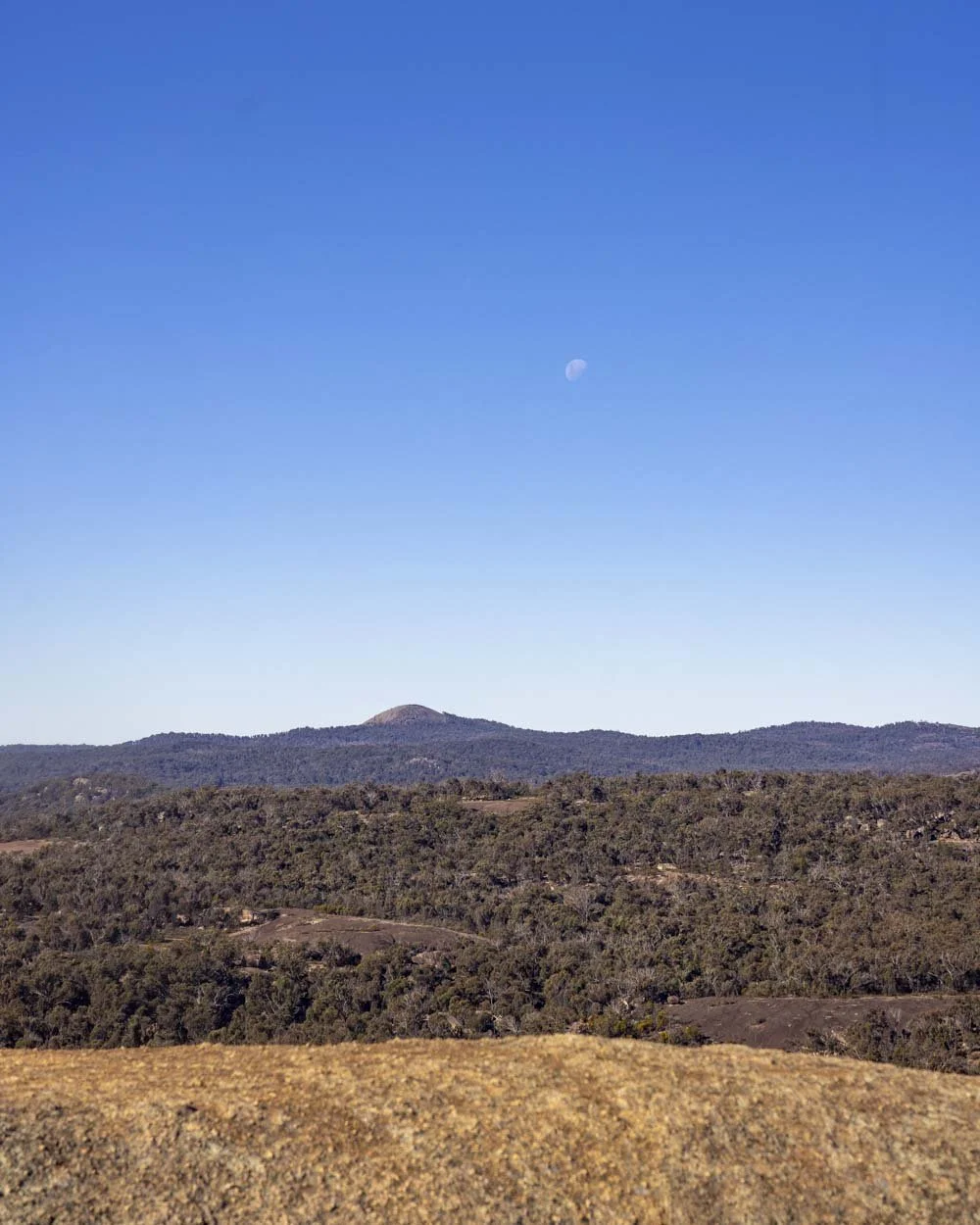
The views from the top are panoramic and there’s plenty of room to spread out and enjoy it - not that there was anyone on the top when we visited despite the fact it was the Queensland school holidays!

Continuing to the Sphinx
From the Castle you head back down to the main track which is 500m away. After another 100m you reach the second junction and from here you begin following for The Sphinx and Turtle Rock.
The first 550m is flat or has some tiny downhill sections before the path begins heading uphill. There are some little flat bits but it’s mainly uphill. About 1km from the junction it gets a little steeper and there are some easy rock slabs to climb.

Roughly 50m later you’ll see the signposted turn off for The Sphinx on your left.
From here you can make your own adventure. The rock formations are incredible and only 50m from the main track you can walk through to the giant rocks that make up The Sphinx, coordinates: -28.859023, 151.942340.

Though it doesn’t necessarily look like a sphinx at close quarters the sheer size and steepness of the boulders is mesmerising. The scale is immense and it’s fun to walk through and see them from different angles.


Continuing to Turtle Rock
Turtle Rock is just 200m beyond the Sphinx, along a well maintained path. You absolutely cannot see that it’s a turtle from here but it’s another fun rock collection.
There’s a sign marking the end of the track (5.2km from the car park) but an obvious well worn path continues beyond the sign.
This will peter out a couple of minutes later as you reach several different rock gullies leading up into the giant boulders. It’s all scrambling from here and as it’s off track, conditions vary - watch for any loose rock.


If you don’t want to climb into the boulders you can sit and relax on the rocks before retracing your steps back to the car park again.

Parking for and getting to The Castle Track
The official trail begins at the Girraween day use area in Girraween National Park, though you could lose 1km from the overall distance by starting at the Castle Rock campground. There is plenty of parking at the main trallhead but only a few spots not meant for campers at the car park (so far as I could see).
These were right by the trailhead at the far end of the campground. Despite the fact there were only a handful of unmarked spaces all were free when we visited in the Queensland school holidays so you should be ok.
It’s 36km and a 30 minute drive from Stanthorpe (QLD) and 39km and a 35 minute drive from Tenterfield (NSW). If you’re coming from Brisbane there are more driving details with two possible routes here.
This post may contain affiliate links, meaning at no additional cost to you, that we will earn a small commission if you click through and decide to make a purchase. This helps towards the costs of running our website. Thanks for your support.


