The Warigala Badha Cultural Walk (more commonly known as Bens Walk) is one of the best trails in Nowra. Much of the walk is spent strolling close to the river, which is especially picturesque during golden hour. However, there’s plenty to keep you entertained besides the river with a fun suspension bridge, endless overhangs, a gorgeous paperbark forest and even a hidden Aboriginal art site.
If you’ve got an hour or two to spare in Nowra and are looking for an easy trail, you won’t be disappointed.

The Warigala Badha Cultural Walk (Bens Walk)
The stats
Distance: 3.6km loop (including side trails)
Elevation gain: 80m
Difficulty: Easy
Trailhead: Scenic Drive, Nowra Showground
Summary: The trail conditions are generally very good on Bens Walk, there is the odd rock and tree root around, but much of the track is smooth. After heavy rain there can be a little mud around, but we could always skirt around it and it was really only significant in one small area.
There is one river crossing which involves using rocks and rock slabs for stepping stones, but it’s very easy and would only really be a problem if the river was exceptionally high.
There are some climbs, but any steep sections are very short and on maintained staircases. The only slight rough bit of track is if you want to find the hidden Aboriginal art cave, which is not part of the maintained trail.
Starting the trail: to the suspension bridge
The walk begins on the western (left) side of the car park and is signposted. You’ll begin heading downhill on a gravel path which soon gives way to uneven stone steps. There is a rail in place if needed.


After just 100m you’ll see the first small overhang on the left which is easy to access, though there are bigger and more impressive caves further along the track.

The uneven descent continues for another couple of hundred metres, but it’s not particularly steep.
There’s a second cave you can climb up into at the 300m mark, but the steps are rotten here and it’s not so easy to access.
Just beyond this you’ll see the suspension bridge and cross over to the other side of the Shoalhaven River. The bridge does look old and rickety, but it doesn’t have that much sway, which will be a pro or con depending on your perspective!

Crossing the river
After crossing the river, the trail heads left and there’s a long flat section on a dirt path. Trees obscure most of the river views along this stretch, but it’s still pleasant enough.
Around 400m into this stretch of track is where we encountered some mud following heavy rain.

You could skirt the edge so it wasn’t too much of a problem, but if it’s been very wet you might not want shoes that you’d prefer to keep pristine.
At the 1.1km mark there’s a bench seat close to the river though it’s strangely just set back enough that you can’t see the water - though you get plenty of good water views along the next section of track.

The path now follows the river more closely and there are often pretty rock walls which make it much more picturesque. There are some rocky sections underfoot along this next part of the walk, but nothing slippery.
At the 1.4km mark you’ll cross the river again, but this time on a series of rocks.
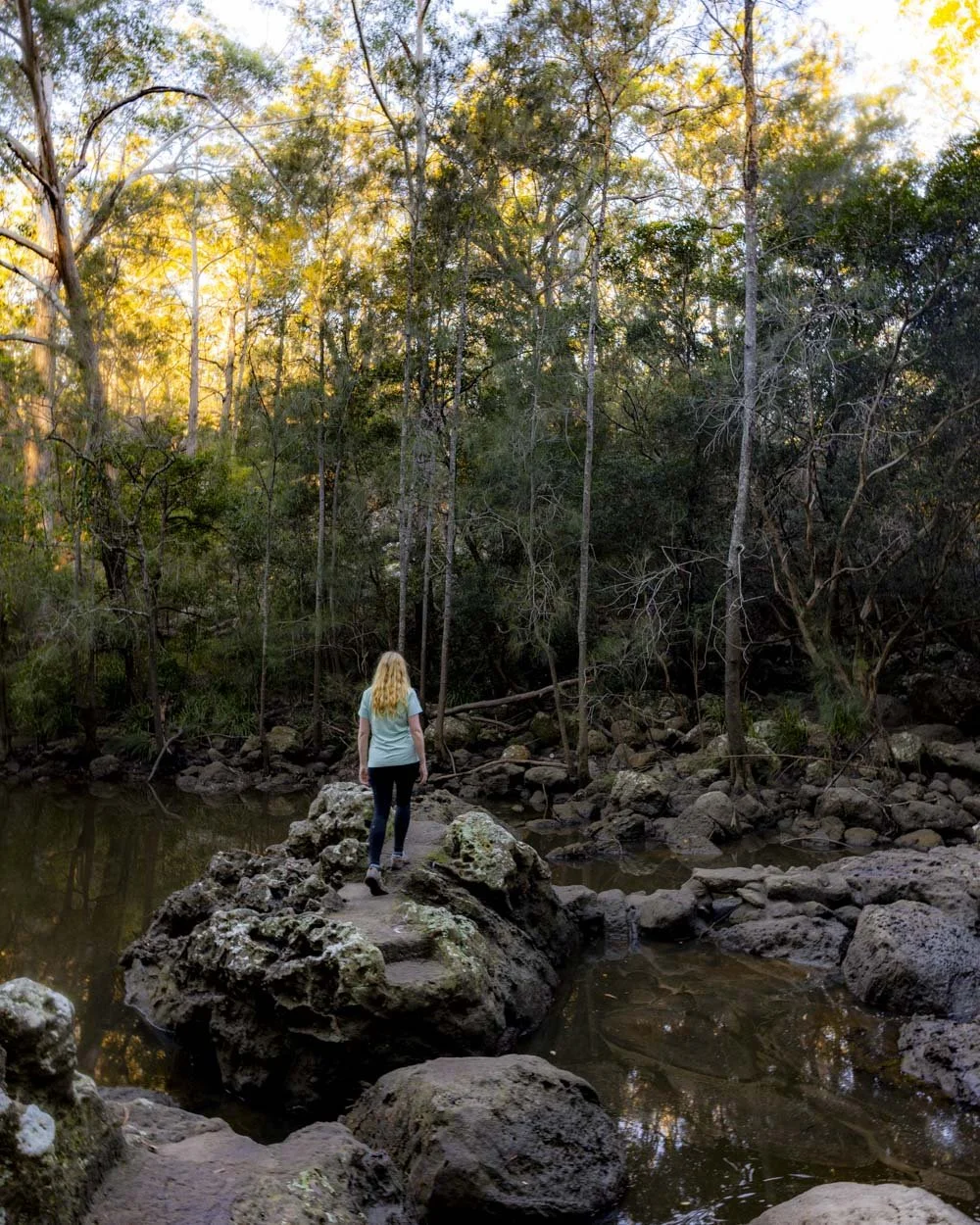
It was all very damp when we visited, but despite that it wasn’t slippery and the crossing was easy as all the rocks are a comfortable distance apart.
It’s sort of a rocky track as opposed to the usual natural rock hopping you find on most trails. I imagine if the river is really high sections could be submerged, but otherwise it’s straightforward.

The trail heads left after the creek crossing, but if you want to visit the Aboriginal art site then you need to make a right here.
Finding the hidden Aboriginal art site
Now before we go into the directions it’s worth noting that there is only really one painting still visible. There is a second painting but it’s very faint.
This is one for the enthusiasts or if you just fancy a short off track detour. We don’t normally give exact directions for unmarked art sites online, but this one is behind a grill so it’s well protected.
From the creek crossing bear right, you’ll have to walk over a few rocks and move towards the cliff wall. Hug the wall and after 50m you’ll see a worn path leading uphill.

This is relatively steep and narrow, but it’s only a very short distance and it’s stable.
After this short climb you will reach a good path above the river and follow it to a rock platform and series of cascades (100m from where you turned off to go uphill).


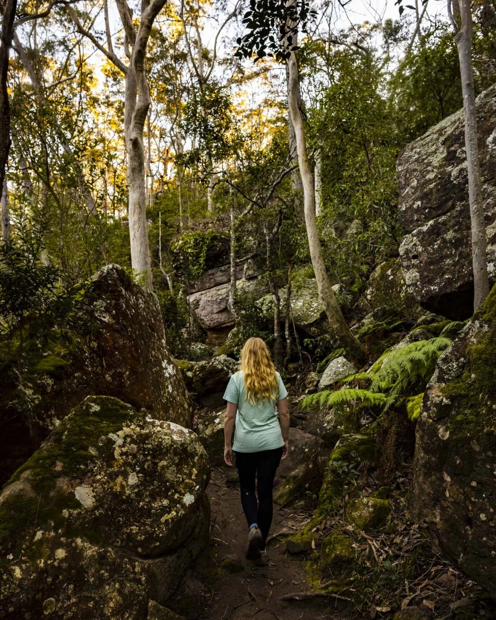
Cross the rocky platform into the bush, watching for the moss on the rock which can be slippery. Follow the worn but slightly overgrown and rough track into the bush and you’ll soon see a leaf litter strewn social trail leading uphill on the left.

It leads towards the large cliff walls. It is uphill but not slippery despite the leaf litter, though watch your step if it’s wet. You’ll easily identify the large overhang with the art on the underside by the grill surrounding it, but for extra guidance it’s at these coordinates: -34.8827077, 150.5910522 (you can see it on Google Maps by clicking here).

It’s only around 30m from the mossy rock platform, so when you know where you’re going it’s less than a ten minute (200m) detour from the main track.
As mentioned the art in the cave is very limited now, it’s hard to see whether there was once more, but the cave wall was quite damp so it could be that some paintings have naturally worn away over time.

Although there is no information board about this site, we believe the main image is of the Rainbow serpent. We also saw a handprint in a slightly different spot, but it was really bright and we’re not sure if it’s genuine.
Though we would have loved to have seen more art, the off track nature of the site still made it fun to visit.

We chose to re-join the main track along a slightly different route on the way back. If you want to do the same, first retrace your steps back to the point at which you climbed uphill from the lower rock wall (before the mossy rock platform and cascades).
Instead of going back down this path continue past it and take the trail on the right. It’s worn and easy to follow, leading to some large rocks.

Between the point you walk past the initial path you climbed up, to the main walking track via this alternate route, is only a distance of 100m. You will descend on a rough track, but it’s a bit less steep than the other path.
There is a tree down over the route 70m before you rejoin the main track, but it’s easy to negotiate. You join the main track a little further along than the creek crossing, so there’s no rock hopping involved using this route.

Completing the circuit and Hanging Rock Lookout
You’re now back on the well formed path and will follow it for 200m before making a left turn. It’s predominantly a flat track and soon enters a truly beautiful Paperbark forest.

This section can have a lot of mosquitoes in the warmer months, but happily during our winter walk we didn’t encounter a single one.
You’ll walk through the forest for 250m and this bit is definitely one of my favourite parts of the whole walk, it’s just so peaceful.

A further 250m after leaving the forest you’ll arrive back at the suspension bridge, but instead of turning uphill back to the car park you continue straight. You’ll now follow an easy path along a particularly lovely part of the river.
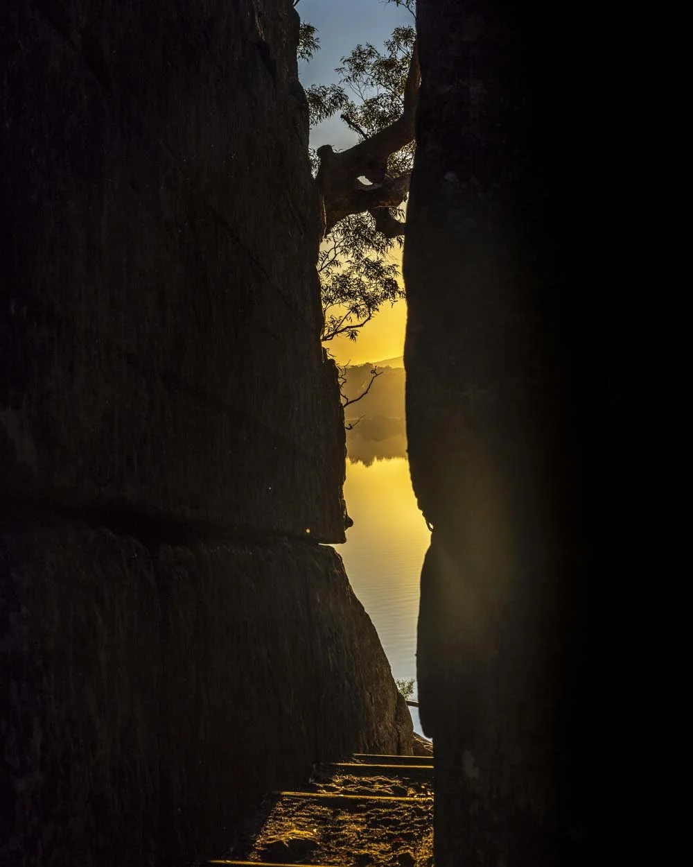
After around 350m you’ll reach several sets of stairs and begin the climb up away from the water. The views are gorgeous, especially during the late afternoon golden light.

After just under 200m you’ll reach a large rock chute which is another very pretty section of track. After climbing the stairs up through the chute you can make another short detour from the main track.
Heading left along the cliff wall will take you to an impressive honeycomb coloured overhang, the best of the walk in my opinion. It’s only a couple of minutes detour each way and well worth it.


After checking out the overhang you retrace your steps back to the chute and continue on the staircases uphill. Partway up the stairs you’ll see an obvious path leading off to the right.
This leads to a view of Hanging Rock from below.

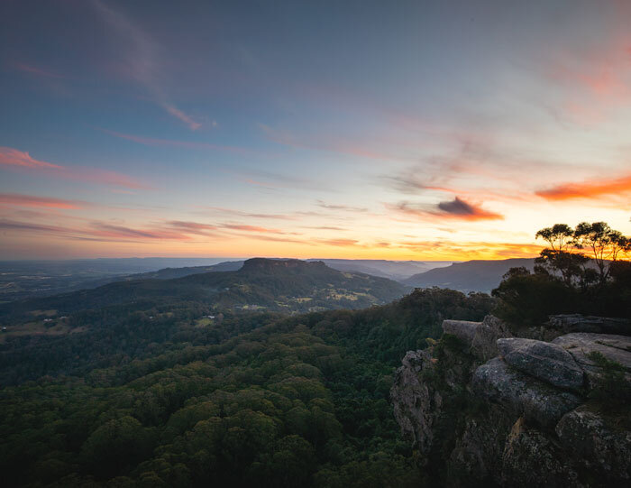
You then continue up the stairs and reach the main Hanging Rock Lookout (60m beyond the rock lookout from below).
Sadly the view is fenced off so it’s lost its wild feel, but it’s still a lovely spot, especially if you time your visit to coincide with sunset. The rock juts out over the Shoalhaven River and the surrounding bushland and distant mountains complete the scene.


From Hanging Rock you're just 50m from the car park.
Getting to the trailhead
The car park for Bens Walk is less than 3km and a five minute drive from the centre of Nowra. There’s plenty of free parking spaces as well as toilets.
This post may contain affiliate links, meaning at no additional cost to you, that we will earn a small commission if you click through and decide to make a purchase. This helps towards the costs of running our website. Thanks for your support.