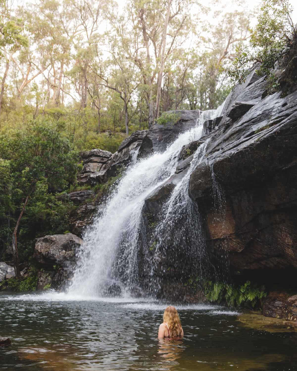
Visiting Scouts Falls is one of the best things to do in Coffs Harbour. This gorgeous waterfall has a deep pool at the base which makes for the perfect wild swimming spot. Although the walk to get there is short, the trail is pretty rough and unmaintained for the majority of the way. It’s a mix of walking over rocks, creek crossings and a few rocky ledges. This only adds to that wild back to nature feeling!
Having said that, we saw several young kids manage it with no problems. If you don’t mind some rough terrain it’s a truly fabulous place to take a dip.
Here’s exactly what to expect on the walk to Scouts Falls.
Scouts Falls
The stats
Distance: 1.6km return
Elevation: 20m
Difficulty: Moderate
The trail to Scouts Falls is short, but as there is no set path for almost the entire way, it takes longer than you think. As you can see from the elevation, there are no uphill sections - it’s just the terrain that slows you down.
You are either walking along rocks, or rocky ledges and parts are a little muddy and slippery (after rain). You’ll probably find the return walk a lot quicker though, as you know which route to take.
To get to the falls you will need to cross the creek twice, so always keep an eye out for a sign of the track on the other side!
The walk to Scouts Falls
To the first swimming hole
The walk begins on a narrow bush track and it’s flat and easy. It doesn’t last long though and you soon reach the start of the rocks and tree roots.
It’s a little muddy but nothing too dramatic and walking along the rocks wouldn’t be difficult if it wasn’t for the fact they are a bit slippery.
If you wear shoes with grip and watch your step it’s not too bad, but it definitely slows you down.
There aren’t any sections which require any big moves or agility, it’s just rocky and/or narrow.
After 250m you come to a set of cascades which also has a lovely swimming hole. If you aren’t enjoying the path you could stop here, and it’s a beautiful place to swim in its own right.
Having said that, in my opinion, the path doesn’t get any harder, so if you’ve done this bit you can definitely get all the way to Scouts Falls.
Onto Scouts Falls
Beyond the first swimming hole, you’ll walk over a number of small rocks for 100m before you come to the creek.
Cross over here and continue along the opposite bank. I flooded my boots in the creek but there had been unusually high rainfall over the last few months so it might be a lot shallower in normal conditions.
You’ll soon come to a narrow rocky ledge and walk along that for the next 150m. There isn’t a big drop off so I wouldn’t say it’s a scary ledge but again it can be a tiny bit slippery.
You will then reach a few boulders which you can use to hop over the creek again.
The boulder crossing over the creek
From here the path is a bit easier, with only one very short ledge to walk across (a few steps) but mainly it’s just a little rocky in places. After 200m you’ll reach the incredible Scouts Falls.
I know we got lucky with a lot of water being in the falls, but I hadn’t expected it to be so spectacular! It really is a very beautiful spot and if you haven’t brought your swimmers with you, you’ll wish you had!
The narrow ledge before reaching Scouts Falls
Swimming at Scouts Falls
The trail to get to the falls might be a little tricky in places but getting into the pool is a breeze. There are virtually no rocks at all to climb over and the bottom is sandy and easy to walk on.
It gets deep pretty quickly too and is large enough for a proper swim. It’s one of my favourite waterfalls to swim at in NSW, and we’ve visited a lot this year!
The colour of the water and the power of the falls is spectacular and it makes for a really atmospheric place to swim.
The water is cold but not freezing (we visited in Autumn) like some water holes as it gets a lot of sun. It’s totally worth that bracing first moment!
How to find the trail for Scouts Falls
The trail to the falls is not marked on Google Maps and nor is the area where you should park. There is no official car park but there is room for quite a few cars to pull off the road in various spots close to the trail head.
To get there head to Glenreagh. Take the Sherwood Creek Road until you see a concrete bridge (there’s also an Aussie Government bridge building sign) and this is the place to park. You can find the exact spot by clicking on this link. Just before the bridge you will see a Sherwood Nature Reserve Sign - the trail begins from here.
The last 2km of the road is unsealed but it’s a gravel road that is in good condition. At time of writing you do not need any kind of high clearance.
This post may contain affiliate links, meaning at no additional cost to you, that we will earn a small commission if you click through and decide to make a purchase. This helps towards the costs of running our website. Thanks for your support.


