There are many different routes you can take to climb to the top of the highest peak in the Brecon Beacons, but the Pen y Fan Horseshoe is a hard one to beat. This trail takes in three iconic Brecon’s peaks, as well as plenty of glorious ridge line walking.
If you’re feeling energetic, you can also add on a fourth peak and take a seat on the photogenic diving board on top of Fan y Big.
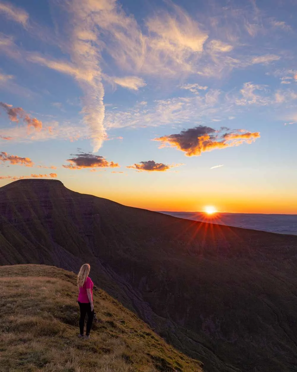
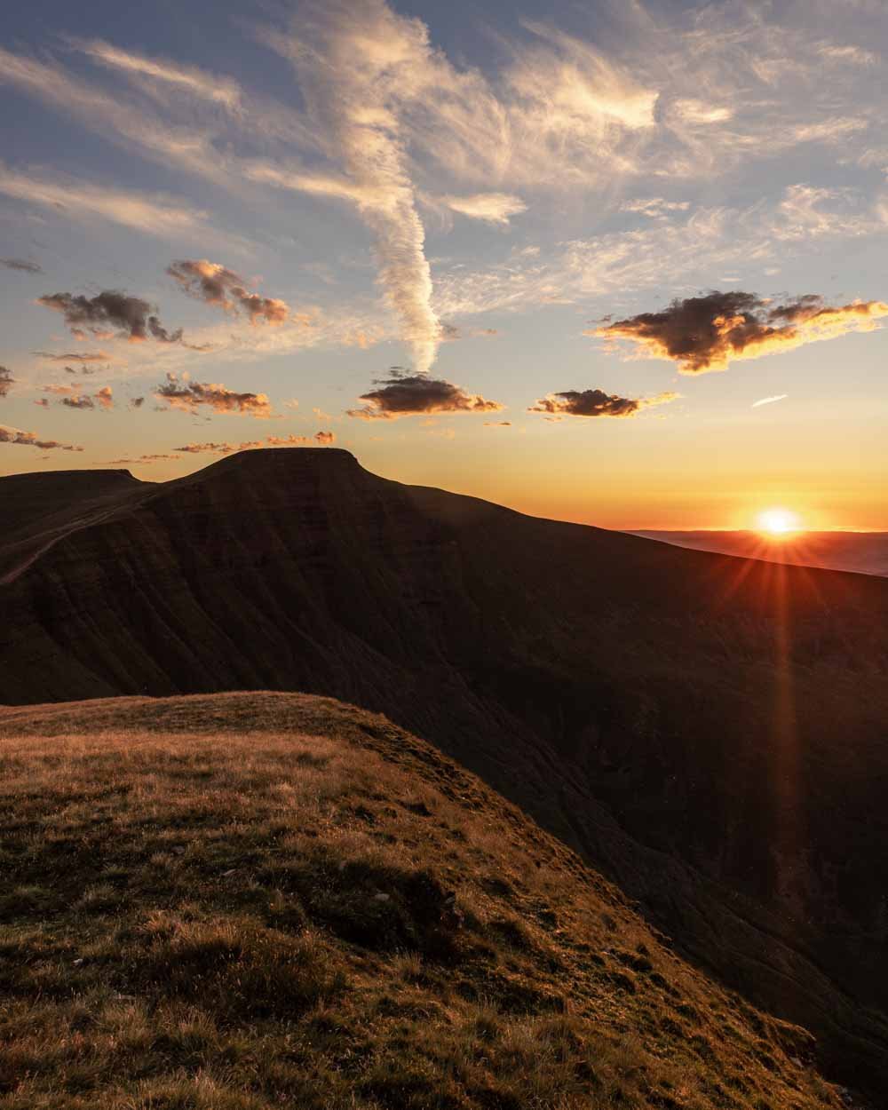
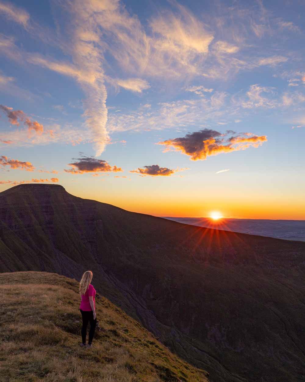
Despite being quite a long walk, there’s very little filler and the great views are with you almost every step of the way. If you want to add a little magic to the track, and avoid all the crowds, you can even time your walk to catch a sunset on top of the final peak (Cribyn) which is an experience you won’t forget.
Here’s everything you need to know about hiking the Pen y Fan Horseshoe.
The Pen y Fan Horseshoe Walk
The stats
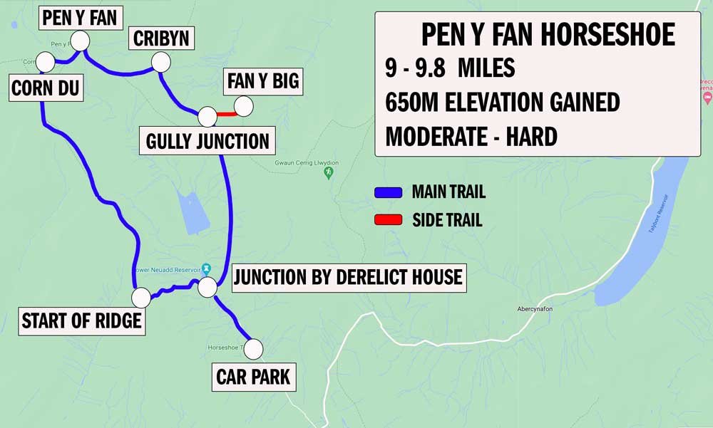
Distance: 9 miles (14.5km) circuit or 9.8 miles (15.8km) with Fan y Big detour
Elevation gain: 650m
Difficulty: Moderate - hard
The Pen y Fan Horseshoe has plenty of elevation gain, but there is a lot of flat track as well, so it’s not relentless. The terrain is generally good, although there are some rough patches on parts of the descents of both Pen y Fan and Cribyn. These descents are steep and can be slippery even when dry.
When wet, the track in general would be much trickier. We had dry conditions, so all the ascents were stable and straightforward, but could become slippery when wet. It’s a stunning walk and for maximum enjoyment you want a dry day and preferably low wind, as it’s really exposed once you’re up on the ridges.
There are no signposts for the walk, but it’s mainly very easy to follow. We’ve noted exact directions below.
What to expect
Starting the trail
From the car park the walk heads up the gravel path and onto the road. You’ll walk left along the road and then take a left again after 300m, still on the paved road. In total, this first section is 0.6 miles (1km) long and completely flat.
It’s a leisurely start to the walk and although road walking is not an exciting start, the views are actually really pretty, so it’s not a hardship.
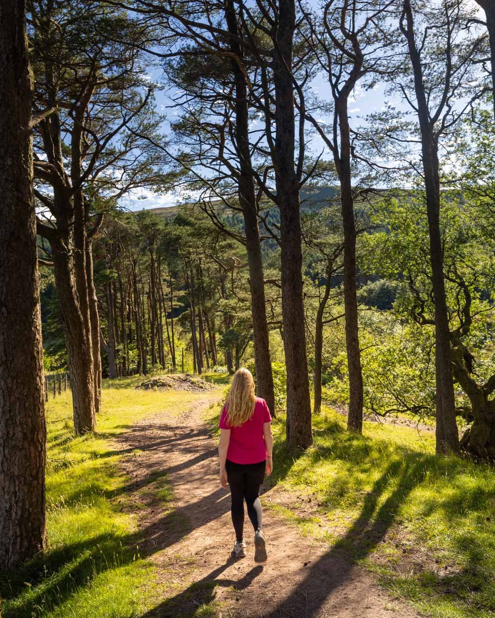
At the 0.6 mile (1km) mark you’ll come to a T junction, with a derelict house on your right. At this point you head left, briefly downhill into the forest, and then alongside the old pumphouse at the Lower Neuadd Reservoir.
You’ll walk over the fence and then over the bridge. From here the track is obvious and you can’t really go wrong.
Roughly 0.8 miles (1.3km) into the trail, it begins heading uphill and this marks the start of the biggest climb of the whole walk, taking you up to the top of the Graig Fan Ddu ridge.
Climbing up to the Graig Fan Ddu ridge
The majority of the climb is on well formed stone steps, or a good gravel path. It’s relatively steep, but not like some of the climbs in the area which go directly uphill and can feel brutal.
The total climb lasts for just over 0.6 miles (1km) and as you get close to the top, the path gets rougher. It’s rocky with some sections of loose soil and also has water running down the track, which makes some sections slippery.
You can usually avoid the wet bits and it doesn’t take too long to cross this section, but it requires a little more care than the earlier part of the climb.
At the 1.5 miles (2.4km) mark, you’ll be standing on top of the ridge and will have climbed 243m of elevation in that last 1km.
Happily that’s the hard work over for a significant amount of time, as the next 2 miles (3.3km) are much more leisurely. The narrow track is in good condition and takes you along the edge of the ridge, with simply spectacular views.
Although you are climbing almost the entire way, the gradient is so shallow as to almost feel flat. It was a surprise when we completed the ridge, and checked the watch to see we’d now covered 425m of elevation, meaning more than half the total climbing on the walk was now behind us.
The last few hundred metres of this section of track before you reach the junction with Corn Du, is downhill, but overall you don’t lose too much of that elevation gain before you begin ascending the first peak.
Climbing Corn Du
The climb up to Corn Du from the junction, which you’ll reach 4 miles (6.4km) into the track, is really short. It’s at this point you can choose to go up and over the peak, or skirt it to the right.
It’s only 400m to the top (60m elevation gain), so it’s little extra effort to climb it and the views are very rewarding.
The initial part of the climb is steep, and the terrain is almost like a cobbled street, but it’s grippy when dry. You’re soon over the hump, where the track levels out, before you reach the official top of the peak.
You get some wonderful views over to Pen y Fan and also down to the atmospheric glacial lake, Llyn Cwm Llwch.
The descent from Corn Du, to where the trail begins climbing up to Pen y Fan, is just 250m long. Although the path is rocky, there’s a handrail in place, so it’s actually the easiest descent of any peak in the Brecons in my opinion!
Finding a handrail here was a real surprise, I’d become used to picking my way down steep descents at a snail’s pace!
To the top of Pen y Fan
From the moment you begin ascending the ridge to Pen y Fan, to the time you reach the top, is just 350m.
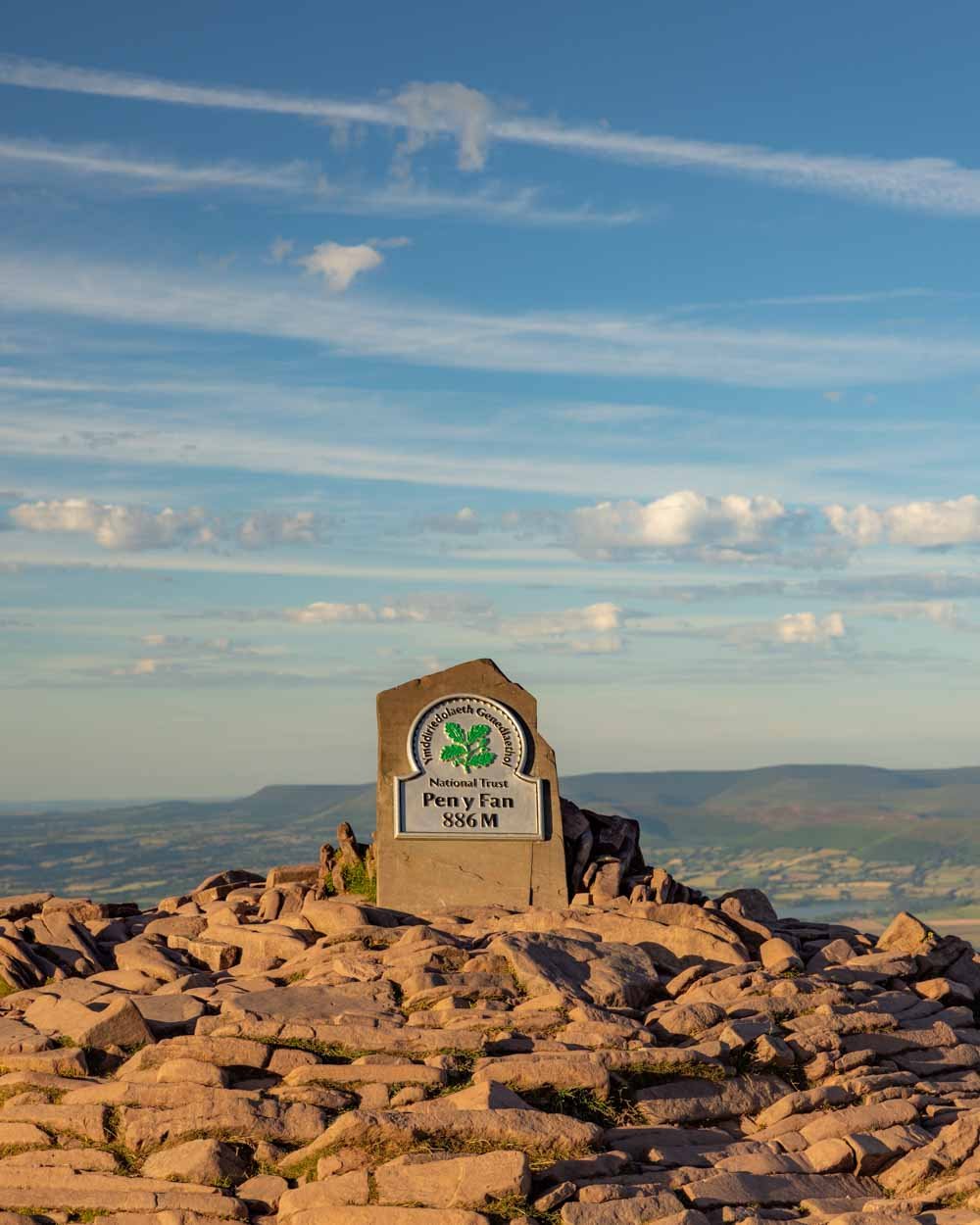
It’s not especially steep - or less so than the climb to the Graig Fan Ddu ridge - so it feels like almost no time has passed between leaving Corn Du and arriving at the top of the highest peak in the Brecon Beacons (886m).
This is 4.3 miles (7.4km) into the trail and you will have climbed a total of 523m in elevation.
The path up is a mix of rocky track and some dirt trail, which is not slippery when dry. You’re then on the wide flat top of Pen y Fan, which has plenty of room to spread out on.
It’s another place you could stop and watch the sunset, and it’s on our list for next time.
The views are gorgeous, offering an expansive look at the surrounding peaks and valleys, and of course over to Cribyn, which you’ll be climbing next.
Ascending Cribyn
The descent from Pen y Fan is steep and lasts approximately 850m. The majority of the descent is on the small stone ‘steps’ that you find on many trails in the area.
The slender nature of the stones make footing more difficult than normal steps, and they can be a touch slippery even when dry.
Luckily it’s not always steep, so you get some sort of respite along the way.
As you descend, you’ll see a popular Brecons photo spot come into view. In fact, this is one of the only pictures I’d seen of the trail, and an absolutely beautiful spot.
There’s a sort of grassy knoll that sticks out with the peak of Cribyn looming behind it.
Unfortunately for us, due to how late we were hiking, the view was partially in shadow, which really doesn’t work well for photos. If you’re keen on getting this shot, you need a cloudy day for even light, or you need to be walking earlier in the day when that side of the valley is not in shadow.
After 850m descending, you’ll reach a junction. You can either go up and over Cribyn, or around the outside, avoiding the climb that begins a couple of hundred metres later.
Unless you are flagging, we’d highly recommend heading up to the top of Cribyn. The climb is 550m long, with an additional 120m elevation gain. It’s steep, but contrary to how it looks from a distance, the path is good.
It’s stony, but grippy in dry weather, and although it’s a lot steeper than climbing either Corn Du or Pen y Fan, it’s definitely worth it.
Plus, the views behind you back towards the steep face of Pen y Fan are fab, so you can legitimately keep stopping for a breather!
Catching sunset from the top of Cribyn
We reached the top of Cribyn 5.7 miles (9.1km) into the walk and there’s a trig point which makes for a good place to stop and take in the views.
There’s also a big grassy bank, which is a great place to sit if it’s been dry.
We were lucky enough to witness a spectacular sunset on top of Cribyn, and the fact there was no one else around made it even more special.
Well, no one until we were just leaving and a camper turned up, it looked like a pretty epic place to spend the night!
The sun sets behind Pen y Fan and casts a beautiful glow over the mountain and surrounding valleys.
Although the sunset view from Pen y Fan is more expansive, Cribyn is far more secluded.
When it comes to descending Cribyn, the first 800m are either flat, or very shallow and on a decent path. The last 650m are much steeper and on the roughest path of the whole walk.
It’s quite eroded and you’re basically walking in a stony gully, which can be a bit slippery even when dry.
It’s not awful and definitely not as bad as some of the trails we’ve done in Snowdonia, but it does require more care unless you’re really surefooted.
Once at the bottom, you can either choose to finish the Horseshoe, or add on the additional peak of Fan y Big.
The Fan y Big detour
As we watched sunset from Cribyn, we didn’t walk to Fan y Big this time. We have done it before though, so we’ll include details on what to expect, along with pictures that will obviously look a bit out of place!
The climb lasts for just 650m, but it’s steep and on those small stone steps - which are ok for ascending, but a pain to descend again afterwards.
It is very much worth it if you haven’t yet been to the top of Fan y Big though.
At the peak, you’ll see the iconic rock that juts out from the cliff side, known as the diving board. It’s not scary, unless you suffer from vertigo and it makes for a fun photo op - although not on a windy day!
The views from Fan y Big are gorgeous and quite different to those you’ve already seen along the way. There’s loads of space to spread out and relax, and once you’re here, all the hard work in terms of climbing is behind you.
You have the steep descent to go, but after that the rest of the walk is entirely flat and all on decent enough terrain.
Completing the circuit
Once you’re back at the junction between Fan y Big and Cribyn, you head along the wide stony path, which is more like a rough road (right from Cribyn or left from Fan y Big).
This next section is flat and easy, although it is rubbly, so not as quick and comfortable underfoot as it could be.
The views are still good, but mainly this is just about finishing up the circuit and there are no more specific sights to see.
There are a couple of ways you can go back and we took the shortest easiest one - which requires turning right at a T junction 1.5 miles (2.4km) after you turned at the junction between Cribyn and Fan y Big.
You’ll come to a gate 200m later and then you’ll turn left along a flat gravel path.
After another 100m you’ll pass a derelict building and turn left. You are now back on the road you came in on and will see the turn off for the narrow path into the car park after 850m.
Parking for the Pen y Fan Horseshoe Walk
The trail begins from the Neuadd Car Park (on Google Maps it is “Pen y Fan Horseshoe Neuadd Car Park”) where the parking is free and time is unlimited. It’s a fair size car park, but even so, it can fill up on weekends and during the school holidays.
There are no facilities at the car park and that includes toilets.
The car park is a 25 minute drive from Merthyr Tydfil, 35 minutes from Brecon, 45 minutes from Abergavenny and 1 hour from Cardiff.
The best time to walk the Pen y Fan Horseshoe
Although the Horseshoe is nowhere near as popular as the shorter more direct routes up Pen y Fan, it does intersect with the most popular route at Corn Du. For this reason, if you don’t like crowds, you’ll want to go early or late if walking on a weekend, or during the school holidays.
We loved going late, as we got an almost empty trail (we only saw a handful of people at Pen y Fan) and got the benefit of watching the sunset from the top of Cribyn.
This post may contain affiliate links, meaning at no additional cost to you, that we will earn a small commission if you click through and decide to make a purchase. This helps towards the costs of running our website. Thanks for your support!

